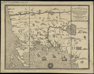
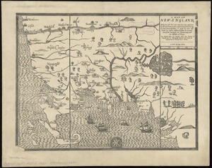
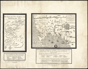
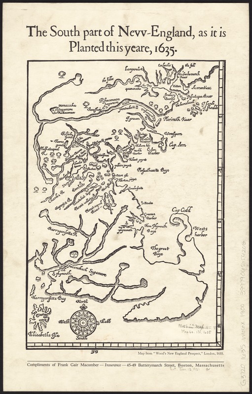
The south part of New-England, as it is planted this yeare, 1635
Item Information
- Title:
- The south part of New-England, as it is planted this yeare, 1635
- Title (alt.):
-
South part of Nevv-England
- Creator:
- Wood, William, fl. 1629-1635
- Date:
-
[1900–1999]
- Format:
-
Maps/Atlases
- Location:
-
Boston Public Library
Norman B. Leventhal Map Center - Collection (local):
-
Norman B. Leventhal Map Center Collection
- Subjects:
-
New England--Maps--Early works to 1800--Facsimiles
- Places:
-
New England (area)
- Extent:
- 1 map ; 31 x 21 cm.
- Terms of Use:
-
No known copyright restrictions.
No known restrictions on use.
- Publisher:
-
Massachusetts :
Frank Gair Macomber
- Scale:
-
Scale [ca. 1:990,000]
- Language:
-
English
- Notes:
-
Facsimile.
- Notes (date):
-
This date is inferred.
- Identifier:
-
06_01_008627
- Call #:
-
G3720 1635 .W66x 1900
- Barcode:
-
39999065654202