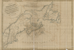
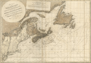
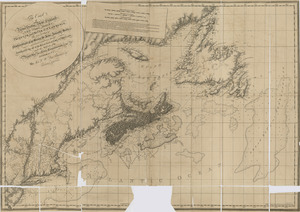
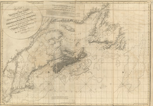
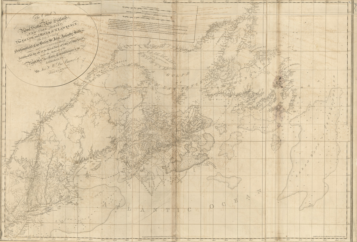
The coast of Nova Scotia, New England, New-York, Jersey, the Gulph and River of St. Lawrence : the islands of Newfoundland, Cape Breton, St. John, Antecosty, Sable, &c, and soundings thereof ...
This map is also available in American Revolutionary Geographies Online (ARGO), a collections portal especially built for material relating to the American Revolutionary War Era. Visit ARGO to learn more about this item and explore the historical geography of North America in the late eighteenth century.
Item Information
- Title:
- The coast of Nova Scotia, New England, New-York, Jersey, the Gulph and River of St. Lawrence : the islands of Newfoundland, Cape Breton, St. John, Antecosty, Sable, &c, and soundings thereof ...
- Publisher:
- Des Barres, Joseph F. W. (Joseph Frederick Wallet), 1722-1824
- Date:
-
1777
- Format:
-
Maps/Atlases
- Location:
- Library of Congress Geography and Map Division
- Collection (local):
-
Library of Congress Geography and Map Division
- Subjects:
-
Atlantic Coast (Maritime Provinces)--Maps
Atlantic Coast (Middle Atlantic States)--Maps
Atlantic Coast (New England)--Maps
- Places:
-
New England (area)
Middle Atlantic (area)
CanadaNova Scotia (province)
- Extent:
- 1 map ; 80 x 117 cm.
- Terms of Use:
-
No known copyright restrictions.
This work is licensed for use under a Creative Commons Attribution Non-Commercial Share Alike License (CC BY-NC-SA).

- Publisher:
-
[London] :
J.F.W. Des Barres
- Scale:
-
Scale [ca. 1:2,000,000]
- Language:
-
English
- Catalog Record:
-
https://lccn.loc.gov/75332500
- Notes:
-
State 3. Two large banks, one southwest of Cape Sable and one off the coast of New England, have been expanded.