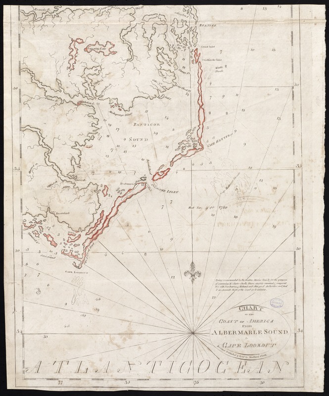
Chart of the coast of America from Albermarle Sound to Cape Lookout
This map is also available in American Revolutionary Geographies Online (ARGO), a collections portal especially built for material relating to the American Revolutionary War Era. Visit ARGO to learn more about this item and explore the historical geography of North America in the late eighteenth century.
Item Information
- Title:
- Chart of the coast of America from Albermarle Sound to Cape Lookout
- Creator:
- Clark, Matthew.
- Date:
-
[1790]
- Format:
-
Maps/Atlases
- Location:
-
Boston Public Library
Norman B. Leventhal Map Center - Collection (local):
-
Norman B. Leventhal Map Center Collection
- Subjects:
-
Nautical charts--North Carolina--Early works to 1800
Coasts--North Carolina--Maps--Early works to 1800
Atlantic Coast (N.C.)--Maps--Early works to 1800
- Places:
-
North Carolina
- Extent:
- 1 map : hand col. ; 56 x 41 cm.
- Terms of Use:
-
No known copyright restrictions.
No known restrictions on use.
- Publisher:
-
Boston :
Published & sold by Matthew Clark
- Scale:
-
Scale [ca. 1:455,000]
- Language:
-
English
- Notes:
-
Depths shown by soundings.
Includes note judging the chart accurate, signed by Osgood Carleton.
Appears in Clark's [Charts of the coast of America from Cape Breton to the entrance of the Gulf of Mexico]. Boston, 1790.
Cataloging, conservation, and digitization made possible in part by The National Endowment for the Humanities: Exploring the human endeavor.
- Notes (date):
-
This date is inferred.
- Identifier:
-
06_01_010390
- Call #:
-
G1106.P5 C5 1790
- Barcode:
-
30000003278479


