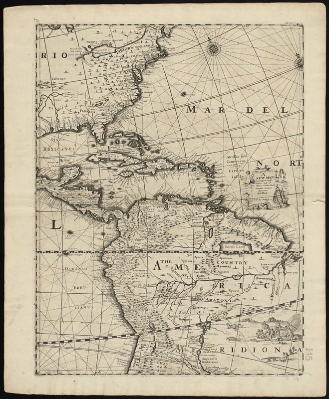
A new map containing the English Empire Golf of Mexico Caribes Islands Granada Guiana Amazone and Peru
Item Information
- Title:
- A new map containing the English Empire Golf of Mexico Caribes Islands Granada Guiana Amazone and Peru
- Title (alt.):
-
Collection of old maps
- Creator:
- Lea, Philip, fl. 1683-1700
- Date:
-
[1700?]
- Format:
-
Maps/Atlases
- Location:
-
Boston Public Library
Norman B. Leventhal Map Center - Collection (local):
-
Norman B. Leventhal Map Center Collection
- Subjects:
-
America--Maps--Early works to 1800
- Places:
-
North and Central America
South America
Mesoamerica (area)
North America (area)
South America
America
- Extent:
- 1 map ; 57 x 43 cm.
- Terms of Use:
-
No known copyright restrictions.
No known restrictions on use.
- Publisher:
-
[London] :
Sold by Philip Lea
- Scale:
-
Scale [ca. 1:1,500,000]
- Language:
-
English
- Notes:
-
Relief shown pictorially.
Oriented with north toward the upper left.
Cataloging, conservation, and digitization made possible in part by The National Endowment for the Humanities: Exploring the human endeavor.
Part of composite portfolio atlas with title "Collection of old maps."
- Identifier:
-
06_01_010215
- Call #:
-
G1015 .C651 1630
- Barcode:
-
30000003238242


