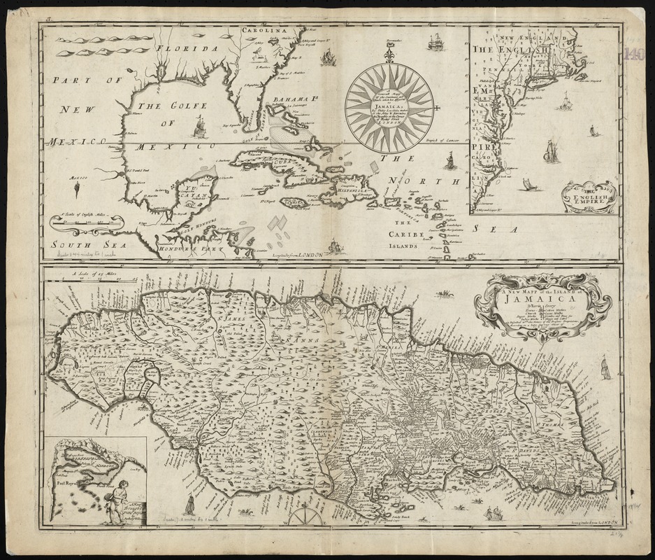
A generall mapp of the continent and islands which bee adjacent to Jamaica : A new mapp of the Island of Jamaica
Item Information
- Title:
- A generall mapp of the continent and islands which bee adjacent to Jamaica : A new mapp of the Island of Jamaica
- Title (alt.):
-
Collection of old maps
- Creator:
- Lea, Philip, fl. 1683-1700
- Name on Item:
-
by Philip Lea.
- Date:
-
[1688]
- Format:
-
Maps/Atlases
- Location:
-
Boston Public Library
Norman B. Leventhal Map Center - Collection (local):
-
Norman B. Leventhal Map Center Collection
- Subjects:
-
West Indies--Maps--Early works to 1800
Jamaica--Maps--Early works to 1800
- Places:
-
Jamaica
West Indies
- Extent:
- 2 maps on 1 sheet ; on sheet 52 x 61 cm.
- Terms of Use:
-
No known copyright restrictions.
No known restrictions on use.
- Publisher:
-
London :
at the Atlas & Hercules in Cheapside at the corner of Fryday Street
- Scale:
-
Scale ca. 1:10,500,000
Scale ca. 1:525,000
- Language:
-
English
- Notes:
-
Relief shown pictorially.
Inset at upper right: The English Empire.
On same plate, below, is "A new mapp of the island of Jamaica," with inset "A new draught of Port Royal by Anthony Williams," [London, 1685].
State 2 according to Burden.
Cataloging, conservation, and digitization made possible in part by The National Endowment for the Humanities: Exploring the human endeavor.
Part of composite portfolio atlas with title "Collection of old maps."
- Notes (date):
-
This date is inferred.
- Identifier:
-
06_01_010220
- Call #:
-
G1015 .C651 1630
- Barcode:
-
30000003238036


