Oxonium comitatus, vulgo Oxford Shire
Item Information
- Title:
- Oxonium comitatus, vulgo Oxford Shire
- Title (alt.):
-
Oxford Shire
Oxfordshire
Collection of old maps
- Creator:
- Jansson, Jan, 1588-1664
- Date:
-
[1646?]
- Format:
-
Maps/Atlases
- Location:
-
Boston Public Library
Norman B. Leventhal Map Center - Collection (local):
-
Norman B. Leventhal Map Center Collection
- Subjects:
-
Oxfordshire (England)--Maps--Early works to 1800
- Places:
-
EnglandOxfordshire (county)
- Extent:
- 1 map ; 37 x 48 cm.
- Terms of Use:
-
No known copyright restrictions.
No known restrictions on use.
- Publisher:
-
Amsterdam :
J. Janssonius
- Scale:
-
Scale [ca. 1:160,000]
- Language:
-
Latin
- Notes:
-
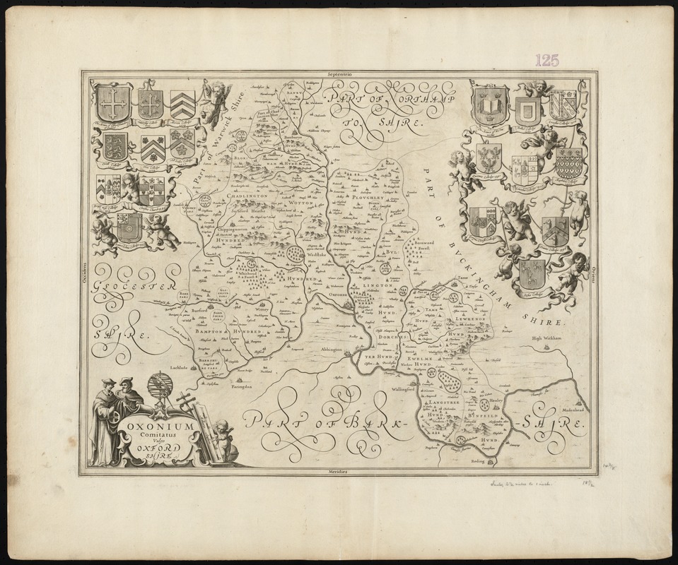
Relief shown pictorially.
Cartouche decorated with figures of scholars, surveyor's tools and a putto holding a compass.
In upper left and right corner are coats of arms of the Oxford University colleges.
Appears in: Nieuwen atlas ofte werelt-beschrijvinge, vertoonende de voornaemste rijckenende landen des gheheelen aerdt-bodems. Vermeerdert met veele schoone landt-kaarten. Nieuwelijcks uytgegeven.... Amsterdam : apud Ioannem Ianssonium, 1657-[87] 6 vols. (Vol. 4, map no. 15)
Cataloging, conservation, and digitization made possible in part by The National Endowment for the Humanities: Exploring the human endeavor.
Part of composite portfolio atlas with title "Collection of old maps."
- Identifier:
-
06_01_010098
- Call #:
-
G1015 .C651 1630
- Barcode:
-
30000003119363


