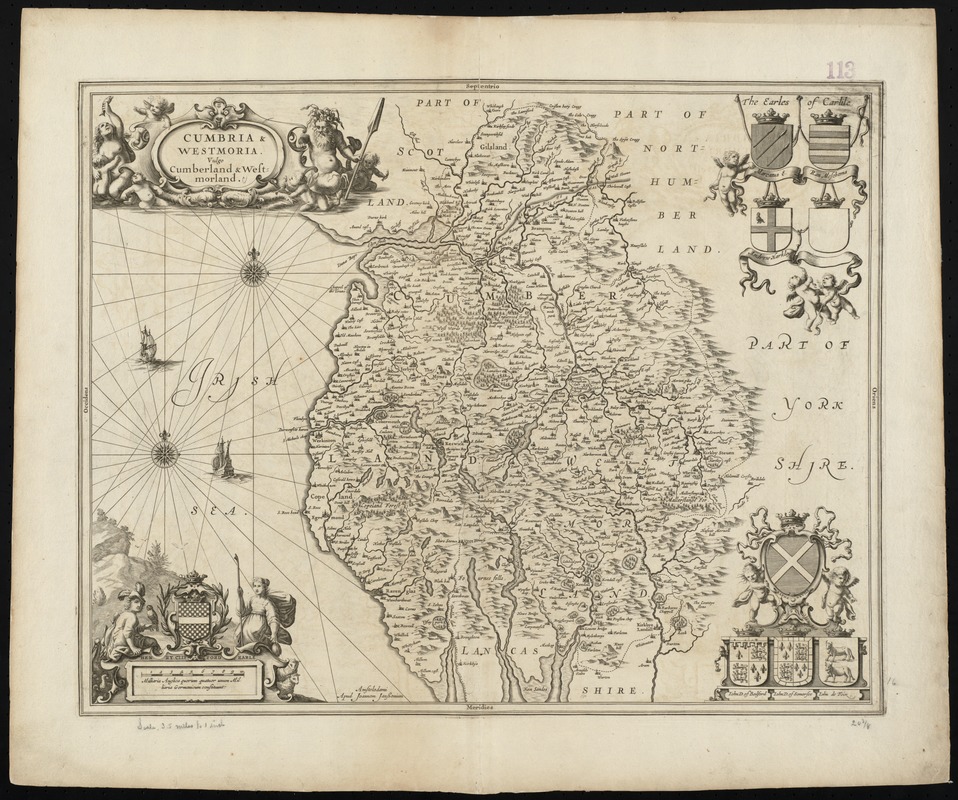
Cumbria & Westmoria : vulgo Cumberland & Westmorland
Item Information
- Title:
- Cumbria & Westmoria : vulgo Cumberland & Westmorland
- Title (alt.):
-
Cumbria and Westmoria
Collection of old maps
- Creator:
- Jansson, Jan, 1588-1664
- Date:
-
[1646–1680]
- Format:
-
Maps/Atlases
- Location:
-
Boston Public Library
Norman B. Leventhal Map Center - Collection (local):
-
Norman B. Leventhal Map Center Collection
- Subjects:
-
Cumberland (England)--Maps--Early works to 1800
Cumbria (England)--Maps--Early works to 1800
Westmorland (England)--Maps--Early works to 1800
- Places:
-
EnglandCumbria (county)Cumberland (area)
EnglandCumbria (county)Westmorland (area)
- Extent:
- 1 map ; 41 x 52 cm.
- Terms of Use:
-
No known copyright restrictions.
No known restrictions on use.
- Publisher:
-
Amstelodami :
Apud Joannem Janssonium
- Scale:
-
Scale [ca. 1:222,000]
- Language:
-
Latin
- Notes:
-
Map of the counties of Cumbria and Westmorland in northern England.
Relief shown pictorially.
Verso is blank.
Title and scale in decorative cartouches.
Includes coats of arms.
Cataloging, conservation, and digitization made possible in part by The National Endowment for the Humanities: Exploring the human endeavor.
Part of composite portfolio atlas with title "Collection of old maps."
- Notes (date):
-
This date is inferred.
- Identifier:
-
06_01_010084
- Call #:
-
G1015 .C651 1630
- Barcode:
-
30000003119264


