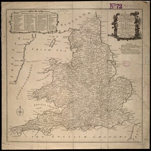
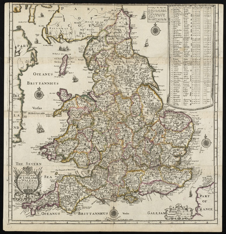
A new map of England and Wales with the direct and cros roads also the number of miles between the townes on the roads by inspection in figures
Item Information
- Title:
- A new map of England and Wales with the direct and cros roads also the number of miles between the townes on the roads by inspection in figures
- Title (alt.):
-
Collection of old maps
- Creator:
- Lea, Philip, fl. 1683-1700
- Name on Item:
-
sold by Phillip Lea ...
- Date:
-
[1690]
- Format:
-
Maps/Atlases
- Location:
-
Boston Public Library
Norman B. Leventhal Map Center - Collection (local):
-
Norman B. Leventhal Map Center Collection
- Subjects:
-
England--Maps--Early works to 1800
Wales--Maps--Early works to 1800
- Places:
-
Wales
England
- Extent:
- 1 map : hand col. ; 50 x 48 cm.
- Terms of Use:
-
No known copyright restrictions.
No known restrictions on use.
- Publisher:
-
London :
Sold by Phillip Lea Globemaker at the Atlas and Hercules in Cheapside near Fryday Street
- Edition:
- 2nd state.
- Scale:
-
Scale [ca. 1:1,300,000]
- Language:
-
English
- Notes:
-
Relief shown pictorially.
Map is comprised of 4 printed strips that have been joined to form one image.
Cataloging, conservation, and digitization made possible in part by The National Endowment for the Humanities: Exploring the human endeavor.
Part of composite portfolio atlas with title "Collection of old maps."
- Notes (date):
-
This date is inferred.
- Identifier:
-
06_01_010001
- Call #:
-
G1015 .C651 1630
- Barcode:
-
3000003115238