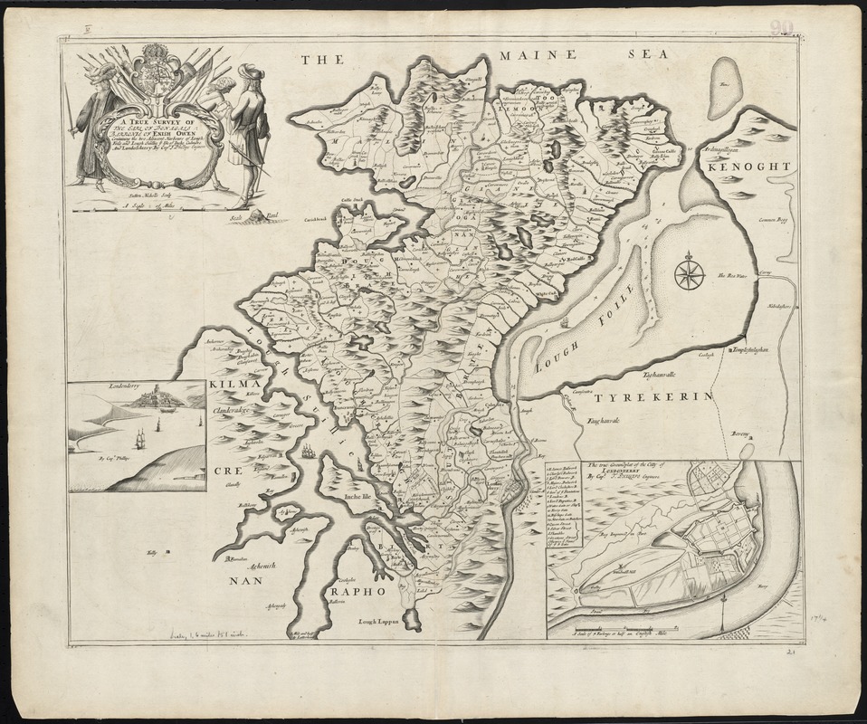
A true survey of The Earl of Donagals barronie of Enish Owen containing the two adjacent harbours of Lough Foile and Lough Suillie ye Isle of Inche Culmore and Londonderry
Item Information
- Title:
- A true survey of The Earl of Donagals barronie of Enish Owen containing the two adjacent harbours of Lough Foile and Lough Suillie ye Isle of Inche Culmore and Londonderry
- Title (alt.):
-
Collection of old maps
- Creator:
- Phillips, Thomas, d. 1693
- Name on Item:
-
by Capt. T. Phillips Enginere.
- Date:
-
[1689–1691]
- Format:
-
Maps/Atlases
- Location:
-
Boston Public Library
Norman B. Leventhal Map Center - Collection (local):
-
Norman B. Leventhal Map Center Collection
- Subjects:
-
Donegal (Ireland : County)--Maps--Early works to 1800
Derry (Northern Ireland)--Maps--Early works to 1800
- Places:
-
IrelandCounty Donegal (county)
United KingdomDerry
- Extent:
- 1 map ; 50 x 56 cm.
- Terms of Use:
-
No known copyright restrictions.
No known restrictions on use.
- Publisher:
-
London? :
Philip Lea?
- Scale:
-
Scale [ca. 1:102,000]
- Language:
-
English
- Notes:
-
Relief shown pictorially.
Imprint derived from Sarah Tyacke's London Map Sellers, 1660-1720, entry number 174.
Sutton Nichols sculp.
Insets: Londonderry; The true groundplat of the Citty of Londonderry.
Cataloging, conservation, and digitization made possible in part by The National Endowment for the Humanities: Exploring the human endeavor.
Part of composite portfolio atlas with title "Collection of old maps."
- Notes (date):
-
This date is inferred.
- Identifier:
-
06_01_010027
- Call #:
-
G1015 .C651 1630
- Barcode:
-
30000003115221


