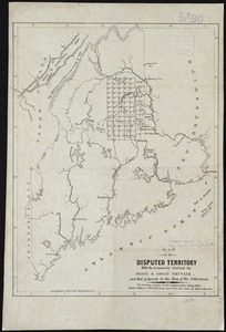
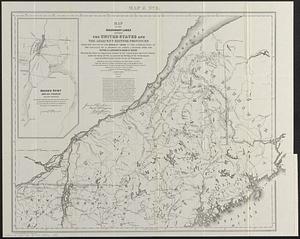
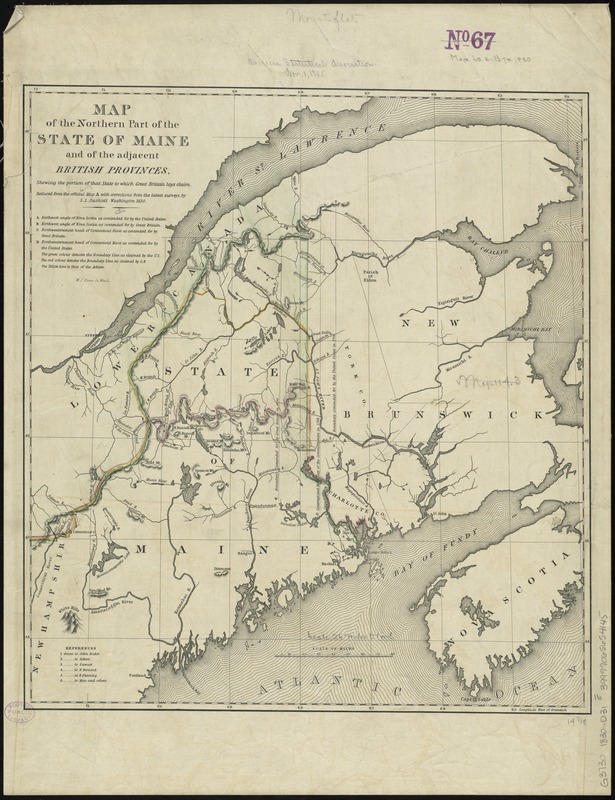
Map of the northern part of the state of Maine and of the adjacent British provinces : shewing the portion of that state to which Great Britain lays claim
Item Information
- Title:
- Map of the northern part of the state of Maine and of the adjacent British provinces : shewing the portion of that state to which Great Britain lays claim
- Creator:
- Dashiell, S. L.
- Name on Item:
-
reduced from the official map A, with corrections from the latest surveys by S.L. Dashiell, Washington, 1830 ; W.J. Stone, sc.
- Date:
-
[1839]
- Format:
-
Maps/Atlases
- Location:
-
Boston Public Library
Norman B. Leventhal Map Center - Collection (local):
-
Norman B. Leventhal Map Center Collection
- Subjects:
-
Aroostook War, 1839--Maps
Maine--Boundaries--New Brunswick--Maps
New Brunswick--Boundaries--Maine--Maps
Northeast boundary of the United States--Maps
United States--Boundaries--Canada--Maps
Canada--Boundaries--United States--Maps
- Places:
-
Maine
CanadaProvince of New Brunswick (province)
- Extent:
- 1 map : hand col. ; 41 x 38 cm.
- Terms of Use:
-
No known copyright restrictions.
No known restrictions on use.
- Publisher:
-
Washington, D.C :
United States Senate
- Scale:
-
Scale [ca. 1:1,600,000]
- Language:
-
English
- Notes:
-
Shows boundary lines in color as claimed by the United States, Great Britain, and the arbiter.
Relief shown pictorially and by hachures.
From: United States. 25th Congress, 3rd session, Senate executive document no. 287, vol. 5, p. 10.
- Notes (date):
-
This date is inferred.
- Identifier:
-
06_01_008515
- Call #:
-
G3730 1830 .D31
- Barcode:
-
39999065654145