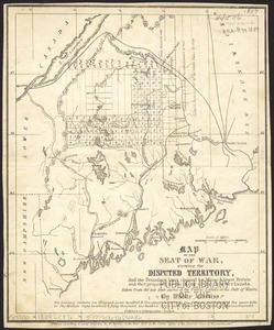
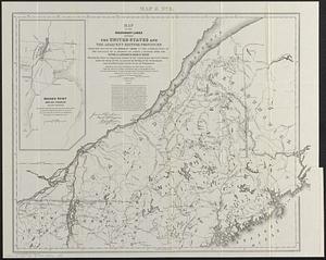
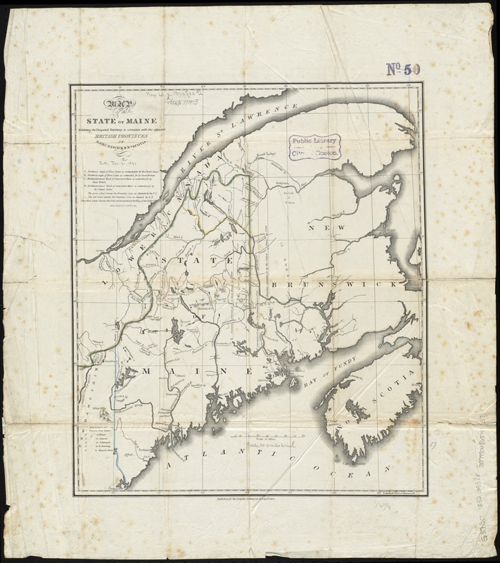
Map of the state of Maine : exhibiting the disputed territory in connexion with the adjacent British provinces of N. Brunswick & Na. Scotia
Item Information
- Title:
- Map of the state of Maine : exhibiting the disputed territory in connexion with the adjacent British provinces of N. Brunswick & Na. Scotia
- Date:
-
[1832?]
- Format:
-
Maps/Atlases
- Location:
-
Boston Public Library
Norman B. Leventhal Map Center - Collection (local):
-
Norman B. Leventhal Map Center Collection
- Subjects:
-
Aroostook War, 1839
Maine--Maps
Northeast boundary of the United States--Maps
United States--Boundaries--Canada--Maps
Canada--Boundaries--United States--Maps
- Places:
-
Maine
CanadaProvince of New Brunswick (province)
- Extent:
- 1 map : hand col. ; 43 x 37 cm.
- Terms of Use:
-
No known copyright restrictions.
No known restrictions on use.
- Publisher:
-
Boston :
Stimpson & Clapp
- Scale:
-
Scale [ca. 1:1,640,000]
- Language:
-
English
- Notes:
-
Shows boundary lines in color as claimed by the United States, Great Britain, and as recommended by the King of the Netherlands.
Relief shown pictorially and by hachures.
"Published for the compiler."
- Identifier:
-
06_01_008516
- Call #:
-
G3730 1832 .M37x
- Barcode:
-
39999065654137
![Map of the disputed territory [Maine]](https://bpldcassets.blob.core.windows.net/derivatives/images/commonwealth:7h14b025h/image_thumbnail_300.jpg)