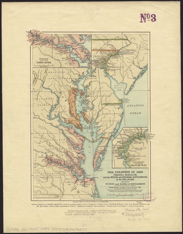
The colonies in 1660, Virginia, Maryland, and the Dutch and Swedish settlements on the Delaware showing extent and dates of settlement
Item Information
- Title:
- The colonies in 1660, Virginia, Maryland, and the Dutch and Swedish settlements on the Delaware showing extent and dates of settlement
- Creator:
- Myers, Albert Cook, 1874-1960
- Name on Item:
-
compiled by Albert Cook Myers.
- Date:
-
1905
- Format:
-
Maps/Atlases
- Location:
-
Boston Public Library
Norman B. Leventhal Map Center - Collection (local):
-
Norman B. Leventhal Map Center Collection
- Subjects:
-
Maryland--Colonies--Maps
Delaware--Colonies--Maps
Virginia--Colonies--Maps
- Places:
-
Virginia
Maryland
Delaware
- Extent:
- 1 map : col. ; 26 x 20 cm
- Terms of Use:
-
No known copyright restrictions.
No known restrictions on use.
- Publisher:
-
Cleveland :
Burrows Bros. Co.
- Scale:
-
Scale [ca. 1:1,800,000]
- Language:
-
English
- Notes:
-
Relief shown by shading.
Insets: Settlements along the James River -- Settlements along the Delaware River.
"Specimen illustration from 'A history of the United States and its people.' by Elroy McKendree Avery."
- Identifier:
-
06_01_008492
- Call #:
-
G3881.S2 1905 .M94
- Barcode:
-
39999065654277


