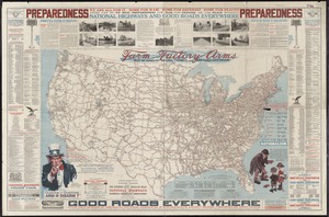
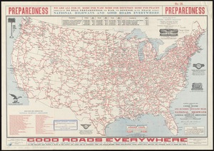
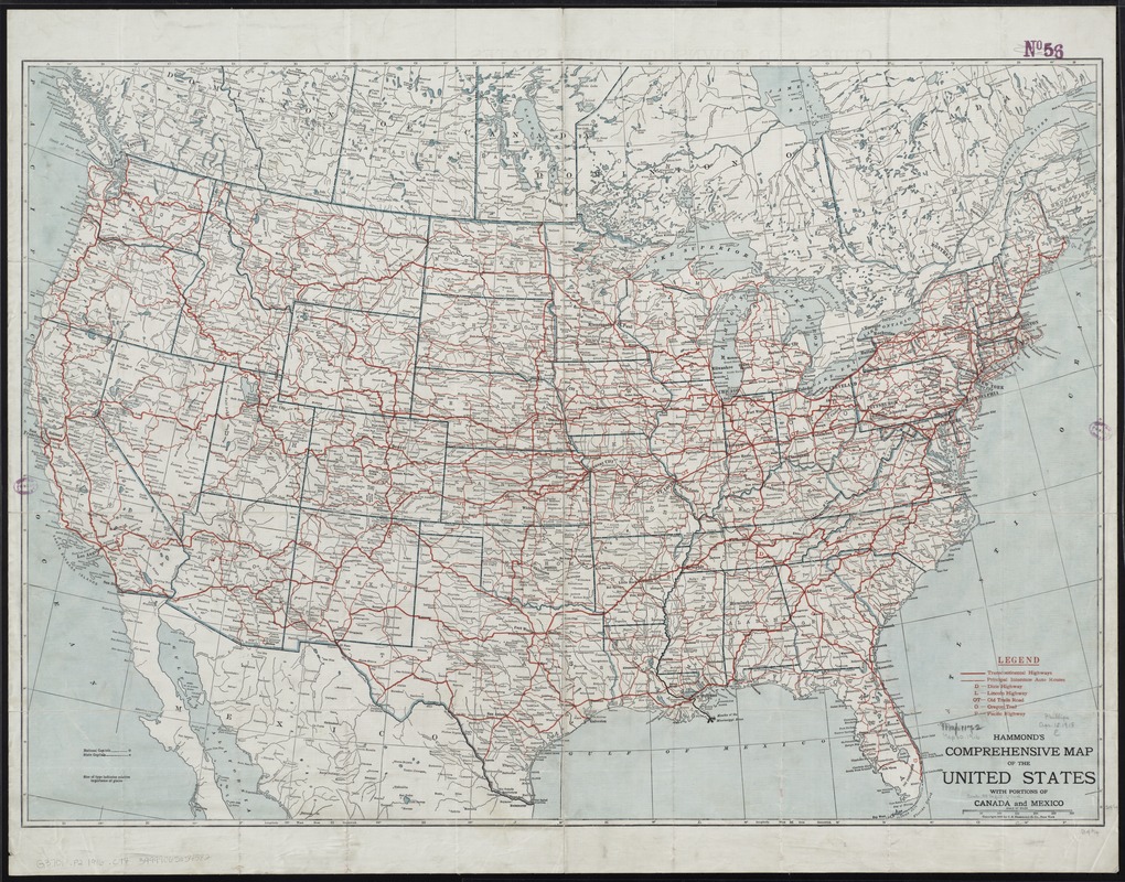
Hammond's comprehensive map of the United States with portions of Canada and Mexico
Item Information
- Title:
- Hammond's comprehensive map of the United States with portions of Canada and Mexico
- Creator:
- C.S. Hammond & Company
- Date:
-
[ca. 1916]
- Format:
-
Maps/Atlases
- Location:
-
Boston Public Library
Norman B. Leventhal Map Center - Collection (local):
-
Norman B. Leventhal Map Center Collection
- Subjects:
-
Roads--United States--Maps
- Places:
-
- Extent:
- 1 map : col. ; 62 x 89 cm.
- Terms of Use:
-
No known copyright restrictions.
No known restrictions on use.
- Publisher:
-
New York, N.Y :
C.S. Hammond
- Scale:
-
Scale [ca. 1:5,000,000]
- Language:
-
English
- Notes:
-
Shows transcontinental highways and principal interstate routes.
On verso: Population figures for U.S. cities from latest census and for Canada from 1911 census.
- Identifier:
-
06_01_008474
- Call #:
-
G3701.P2 1916 .C74
- Barcode:
-
39999065654582