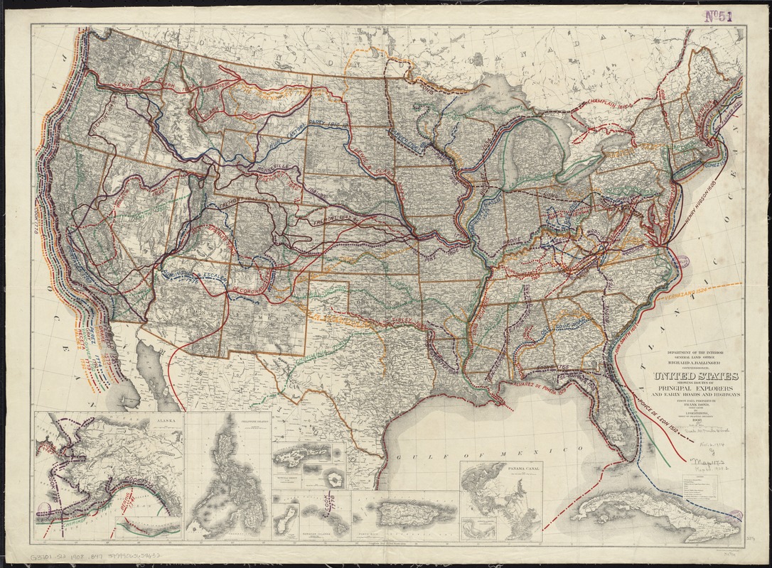
United States showing routes of principal explorers and early roads and highways
Item Information
- Title:
- United States showing routes of principal explorers and early roads and highways
- Description:
-
America Transformed: Frank Bond, a General Land Office surveyor, draftsman, and finally Chief Clerk, created this thematic, historical map that was atypical of other GLO publications. He compiled the major Spanish, Dutch, French, British, and American routes during four centuries of Euro-American exploration. This colorful presentation was overlaid on a standard base map that showed the extent of township surveys by the beginning of the 20th century. The map demonstrated the current state of geographical knowledge and suggested that by this time there was little unmapped land.
- Creator:
- Berthrong, I. P.
- Name on Item:
-
from data prepared by Frank Bond ; by I.B. Berthrong.
- Date:
-
1908
- Format:
-
Maps/Atlases
- Location:
-
Boston Public Library
Norman B. Leventhal Map & Education Center - Collection (local):
-
Norman B. Leventhal Map & Education Center Collection
- Subjects:
-
Explorers--United States--Maps
United States--Maps
United States--Discovery and exploration--Maps
- Places:
-
United States
- Extent:
- 1 map : col. ; 59 x 81 cm.
- Terms of Use:
-
No known copyright restrictions.
No known restrictions on use.
- Publisher:
-
[Washington, D.C.] :
Dept. of the Interior, General Land Office
- Scale:
-
Scale [ca. 1:6,000,000]
- Language:
-
English
- Notes:
-
Relief shown by hachures.
Insets: Alaska -- Philippine Islands -- Tutuila Group of the Samoan Islands -- Manua -- Guam or Cuajan Island -- Hawaiian Islands -- Porto Rico -- Panama Canal -- Isthmus of Panama showing location of canal.
- Notes (exhibitions):
-
Exhibited: "America transformed. Part 1: the United States expands westward," organized by the Norman B. Leventhal Map & Education Center at the Boston Public Library, 2019.
- Identifier:
-
06_01_008479
- Call #:
-
G3701.S12 1908 .B47
- Barcode:
-
39999065654632


