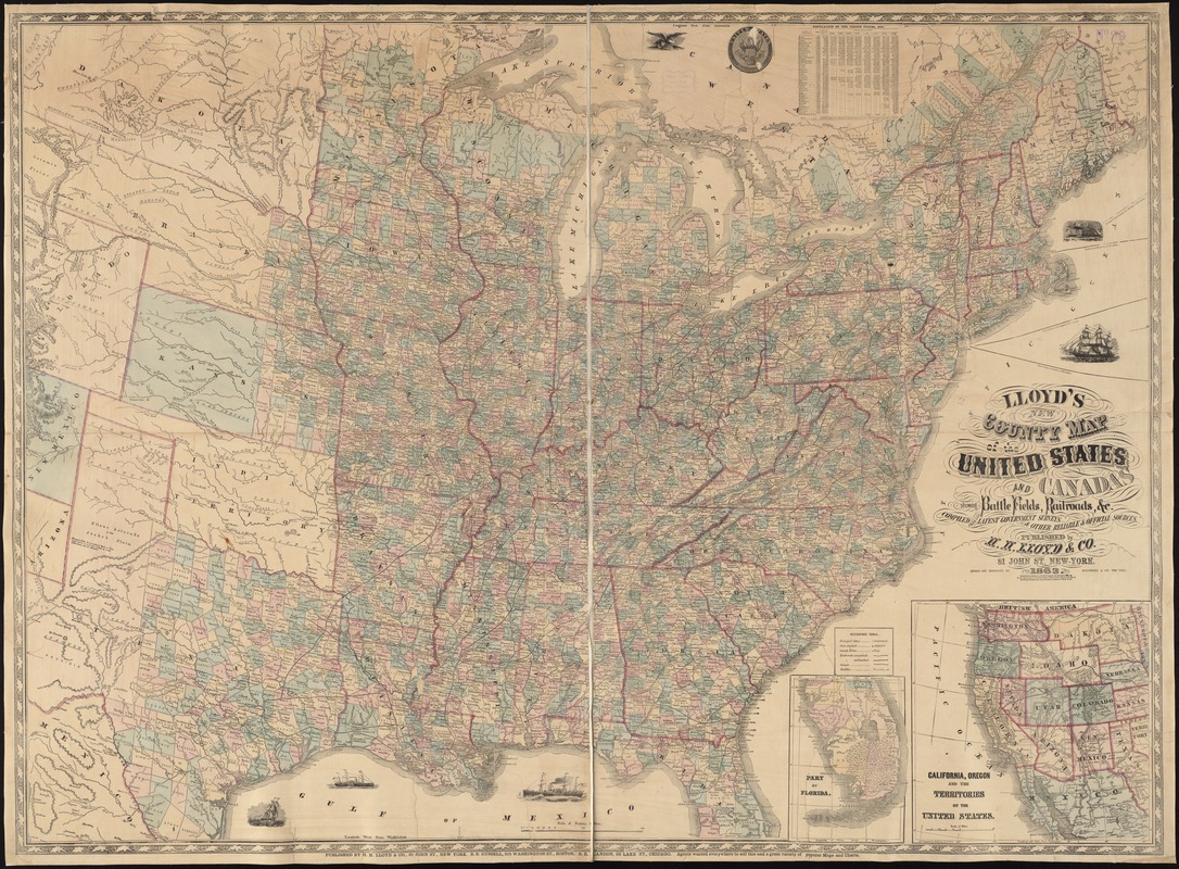
Lloyd's new county map of the United States and Canadas showing battle fields, railroads, &c., compiled from the latest goverment surveys & other reliable & official sources
Item Information
- Title:
- Lloyd's new county map of the United States and Canadas showing battle fields, railroads, &c., compiled from the latest goverment surveys & other reliable & official sources
- Description:
-
Indicates location and date of engagements, towns, railroads, state and county boundaries, and rivers.
- Creator:
- Schönberg & Co
- Name on Item:
-
drawn and engraved by Schönberg & Co.
- Date:
-
1863
- Format:
-
Maps/Atlases
- Location:
-
Boston Public Library
Norman B. Leventhal Map Center - Collection (local):
-
Norman B. Leventhal Map Center Collection
- Subjects:
-
Railroads--United States--Maps
United States--Maps
United States--History--Civil War, 1861-1865--Maps
- Places:
-
- Extent:
- 1 map : hand col. ; 97 x 132 cm.
- Terms of Use:
-
No known copyright restrictions.
No known restrictions on use.
- Publisher:
-
New York :
H. H. Lloyd & Co.
- Scale:
-
Scale [ca. 1:2,500,000]
- Language:
-
English
- Notes:
-
Relief shown by hachures.
Insets: Part of Florida -- California, Oregon and the territories of the United States.
Includes population table.
- Identifier:
-
06_01_008451
- Call #:
-
G3700 1863 .S36
- Barcode:
-
39999065654889
- LCCN:
-
98688333


