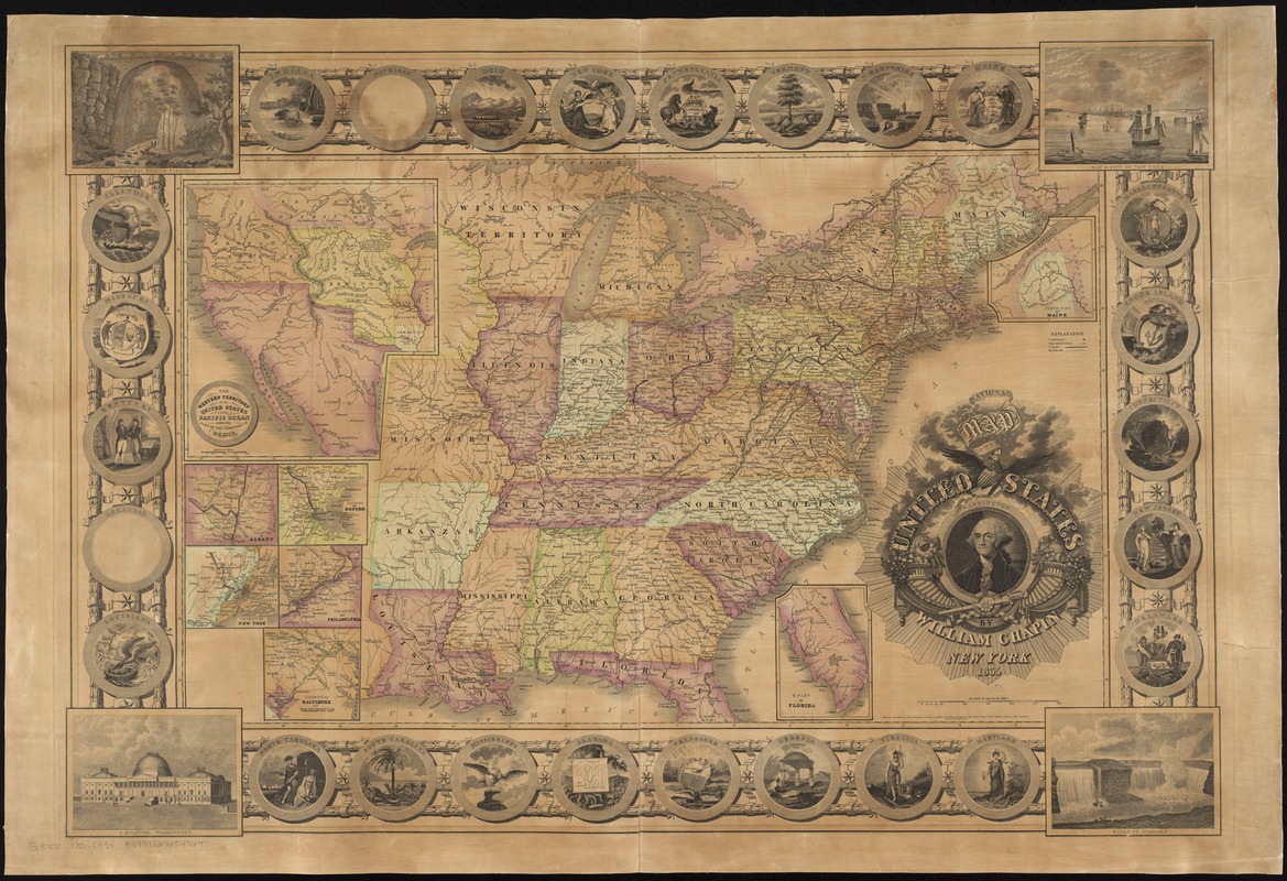
National map of the United States
Item Information
- Title:
- National map of the United States
- Creator:
- Chapin, William, 1802-1888
- Name on Item:
-
by William Chapin.
- Date:
-
1835
- Format:
-
Maps/Atlases
- Location:
-
Boston Public Library
Norman B. Leventhal Map Center - Collection (local):
-
Norman B. Leventhal Map Center Collection
- Subjects:
-
United States--Maps
- Places:
-
- Extent:
- 1 map : hand col. ; 44 x 72 cm.
- Terms of Use:
-
No known copyright restrictions.
No known restrictions on use.
- Publisher:
-
New York :
William Chapin
- Scale:
-
Scale [ca. 1:4,440,000]
- Language:
-
English
- Notes:
-
Relief shown by hachures.
Insets: Western territory of the United States to the Pacific Ocean embracing part of the territory of Mexico -- Vicinity of Albany -- Vicinity of Boston -- Vicinity of New York -- Vicinity of Philadelphia -- Vicinity of Baltimore and Washington -- North part of Maine -- S. part of Florida.
Decorative border includes views and illustrations of states seals.
- Identifier:
-
06_01_008439
- Call #:
-
G3700 1835 .C43x
- Barcode:
-
39999065654764


