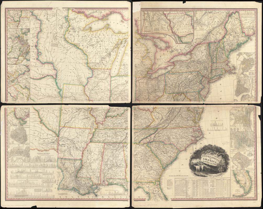
United States of America
Item Information
- Title:
- United States of America
- Creator:
- Tanner, Henry Schenck, 1786-1858
- Contributor:
- Allen, William, 19th cent
- Contributor:
- Dawson, E. B.
- Engraver:
- Knight, J.
- Contributor:
- Steel, James W., 1799-1879
- Name on Item:
-
by H. S. Tanner ; engraved by H. S. Tanner, assisted by E. B. Dawson, W. Allen & J. Knight ; J. W. Steel sc.
- Date:
-
1830
- Format:
-
Maps/Atlases
- Location:
-
Boston Public Library
Norman B. Leventhal Map Center - Collection (local):
-
Norman B. Leventhal Map Center Collection
- Subjects:
-
United States--Maps
- Places:
-
- Extent:
- 1 map on 4 sheets : hand col. ; 148 x 116 cm., on sheets 64 x 80 cm.
- Terms of Use:
-
No known copyright restrictions.
No known restrictions on use.
- Publisher:
-
Philadelphia :
[Henry S. Tanner]
- Edition:
- 2nd ed.
- Scale:
-
Scale [ca. 1:2,025,000]
- Language:
-
English
- Notes:
-
Relief shown by hachures.
Prime meridian: Washington.
Includes 16 insets, profiles, and statistical tables.
- Identifier:
-
06_01_008440
- Call #:
-
G3700 1830 .T36x
- Barcode:
-
39999065654772


