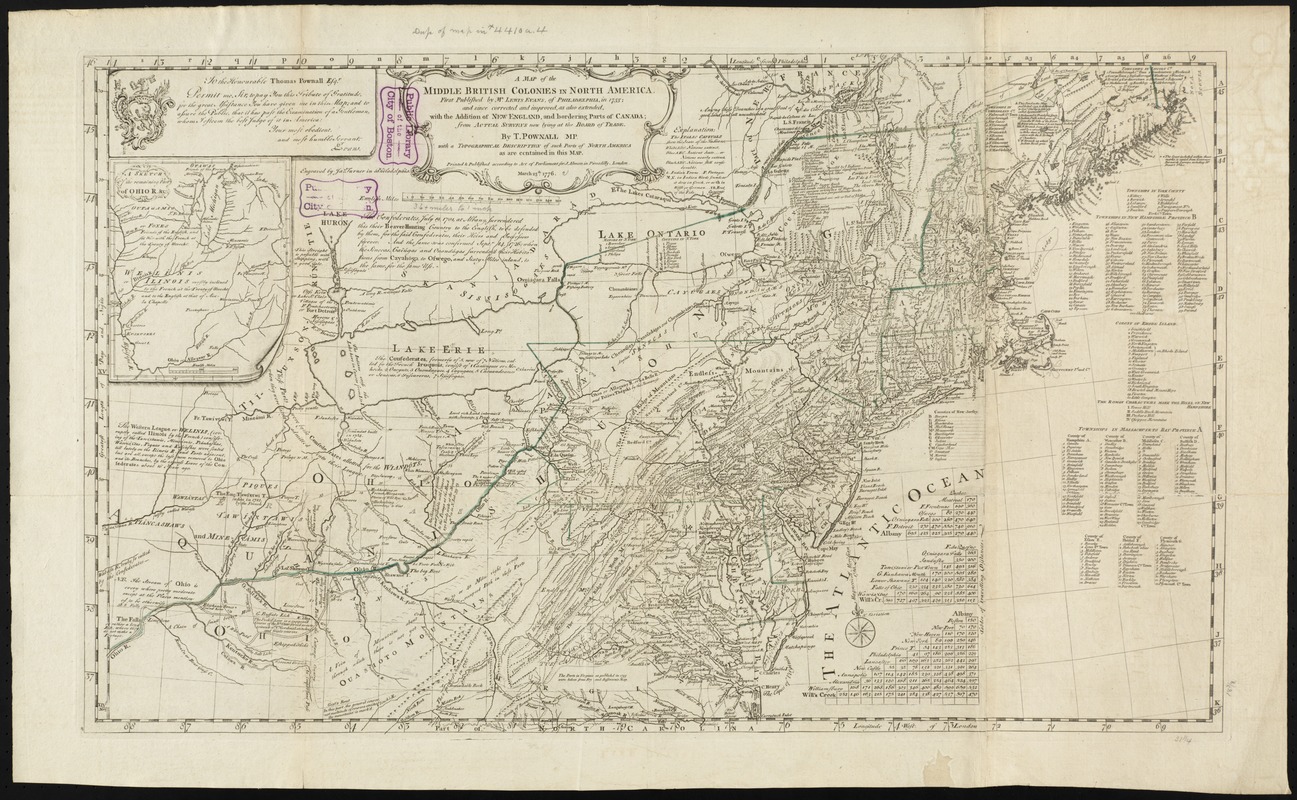
A map of the middle British colonies in North America : first published by Mr. Lewis Evans, of Philadelphia, in 1755; and since corrected and improved, as also extended, with the addition of New England, and bordering parts of Canada; from actual surveys now lying at the Board of Trade
This map is also available in American Revolutionary Geographies Online (ARGO), a collections portal especially built for material relating to the American Revolutionary War Era. Visit ARGO to learn more about this item and explore the historical geography of North America in the late eighteenth century.
Item Information
- Title:
- A map of the middle British colonies in North America : first published by Mr. Lewis Evans, of Philadelphia, in 1755; and since corrected and improved, as also extended, with the addition of New England, and bordering parts of Canada; from actual surveys now lying at the Board of Trade
- Title (alt.):
-
Collection of North American maps
- Creator:
- Pownall, Thomas, 1722-1805
- Name on Item:
-
by T. Pownall, mp. ;engraved by Jas. Turner in Philadelphia.
- Date:
-
1776
- Format:
-
Maps/Atlases
- Location:
-
Boston Public Library
Norman B. Leventhal Map Center - Collection (local):
-
Norman B. Leventhal Map Center Collection
- Subjects:
-
Northeastern States--Maps--Early works to 1800
Middle Atlantic States--Maps--Early works to 1800
Great Britain--Territories and possessions--Maps--Early works to 1800
- Places:
-
Northeastern United States (area)
Middle Atlantic (area)
- Extent:
- 1 map ; 49 x 80 cm.
- Terms of Use:
-
No known copyright restrictions.
No known restrictions on use.
- Publisher:
-
London :
Printed & published according to Act of Parliament for J. Almon in Picadilly
- Scale:
-
Scale [ca. 1:2,350,000]
- Language:
-
English
- Notes:
-
Relief shown pictorially.
Prime meridian: London and Philadelphia.
Includes text, list of townships, distance charts, and inset "A sketch of the remaining part of Ohio R. &c."
Conservation of this piece was funded by Lavinia Lee Witt Touchton of Tampa, Florida in memory of her father, Currie B. Witt, whose study of Benjamin Franklin was a positive influence in his life.
Boston Public Library copy in portfolio with a map of the Gulf Stream once belonging to Benjamin Franklin. Note reads: "These maps belonged to a lot brought by Dr. Franklin from Europe, and are given to this Library by Dr. Thomas Hewson Bache, 233 South 13th St., Phil. Recd. this Dr. S.A. Green."
- Identifier:
-
06_01_008790
- Call #:
-
G3300 1776 .F73x
- Barcode:
-
30000003833728
- LCCN:
-
74693076


