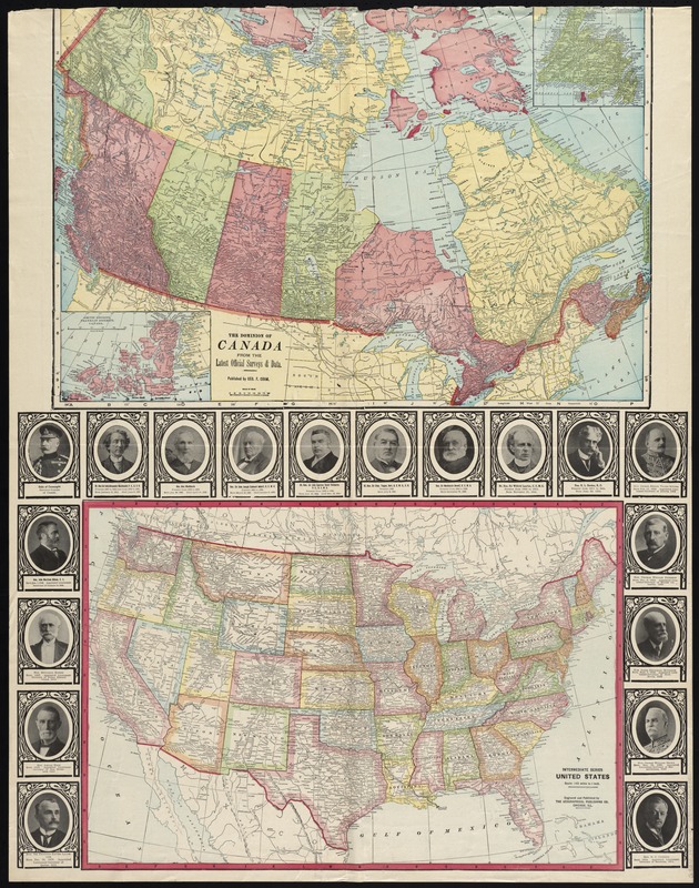
The Dominion of Canada from the latest surveys and data
Item Information
- Title:
- The Dominion of Canada from the latest surveys and data
- Title (alt.):
-
Intermediate series United States
- Creator:
- Cram, George Franklin, 1841-1928
- Date:
-
[1913]
- Format:
-
Maps/Atlases
- Location:
-
Boston Public Library
Norman B. Leventhal Map Center - Collection (local):
-
Norman B. Leventhal Map Center Collection
- Subjects:
-
Canada--Maps
United States--Maps
- Places:
-
United States
Canada
- Extent:
- 2 maps on 1 sheet : col. ; 41 x 62 cm. and 37 x 55 cm., on sheet 90 x 70 cm.
- Terms of Use:
-
No known copyright restrictions.
No known restrictions on use.
- Publisher:
-
Vancouver, B.C :
News-Advertiser
- Scale:
-
Scale [ca. 1:8,200,000]
Scale [1:9,187,200]. 145 miles to 1 inch
- Language:
-
English
- Notes:
-
Canada map insets: [Newfoundland] -- Arctic regions, Franklin District, Canada.
Includes portraits of Canadian officials.
Text, illustration, and table on verso.
- Notes (date):
-
This date is inferred.
- Identifier:
-
06_01_008425
- Call #:
-
G3510 1913 .N49x
- Barcode:
-
39999065653840


