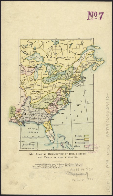
Map showing distribution of indian stocks and tribes, between 1710-1720
Item Information
- Title:
- Map showing distribution of indian stocks and tribes, between 1710-1720
- Creator:
- Mooney, James, 1861-1921
- Name on Item:
-
James Mooney.
- Date:
-
[1904]
- Format:
-
Maps/Atlases
- Location:
-
Boston Public Library
Norman B. Leventhal Map Center - Collection (local):
-
Norman B. Leventhal Map Center Collection
- Subjects:
-
Indians of North America--Maps
Indian reservations--Maps
United States--Maps
- Places:
-
- Extent:
- 1 map : col. ; 17 x 16 cm.
- Terms of Use:
-
No known copyright restrictions.
No known restrictions on use.
- Publisher:
-
Cleveland, Ohio :
Burrows Brothers Company
- Scale:
-
Scale [ca. 1:19,200,000]
- Language:
-
English
- Notes:
-
Specimen illustration from 'A history of the United States and its people.' by Elroy McKendree Avery.
- Notes (date):
-
This date is inferred.
- Identifier:
-
06_01_008417
- Call #:
-
G3701.E1 1904 .M66x
- Barcode:
-
39999065653972