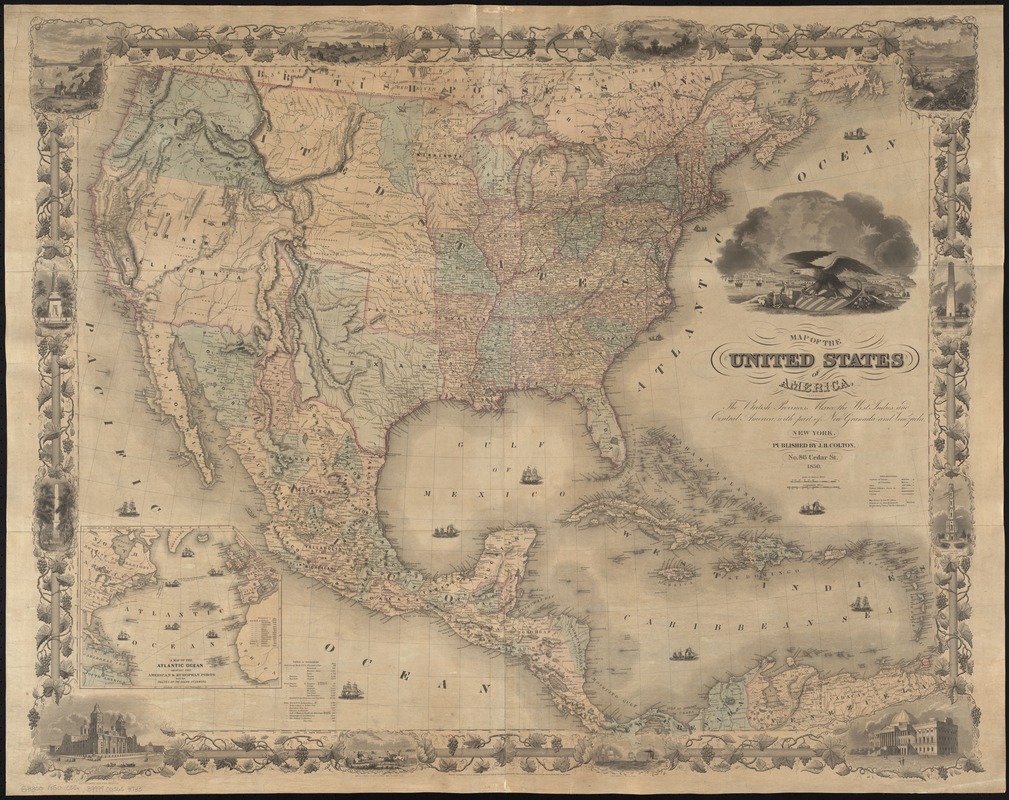
Map of the United States of America, the British provinces, Mexico, the West Indies and Central America, with part of New Granada and Venezuela
Item Information
- Title:
- Map of the United States of America, the British provinces, Mexico, the West Indies and Central America, with part of New Granada and Venezuela
- Creator:
- Colton, G. Woolworth (George Woolworth), 1827-1901
- Engraver:
- Atwood, John M., b. ca. 1818
- Engraver:
- Barnard, William S., b. ca. 1809
- Name on Item:
-
map drawn by Geo. W. Colton ; engraved by John M. Atwood ; border desig'd. & eng'd. by W.S. Barnard.
- Date:
-
1850
- Format:
-
Maps/Atlases
- Location:
-
Boston Public Library
Norman B. Leventhal Map Center - Collection (local):
-
Norman B. Leventhal Map Center Collection
- Subjects:
-
North America--Maps
Atlantic Ocean--Maps
- Places:
-
North America (area)
Atlantic Ocean
- Extent:
- 1 map : col. ; 77 x 97 cm.
- Terms of Use:
-
No known copyright restrictions.
No known restrictions on use.
- Publisher:
-
New York :
Published by J.H. Colton
- Scale:
-
Scale [ca. 1:6,500,000].
- Language:
-
English
- Notes:
-
Relief shown by hachures.
Covers also parts of South America and Canada.
Shows cities and towns, Indian tribal areas, railroads, canals, drainage, etc.
Prime meridians: Washington, D.C. and Greenwich.
Inset: A map of the Atlantic Ocean showing the American & European ports and the routes of the ocean steamers.
Includes tables of distances.
"Entered according to Act of Congress in the year 1848 by J.H. Colton in the Clerk's Office of the District Court for the Southern District of New York."
Map surrounded by a decorative border of grapevines, historical vignettes, and U.S. buildings and monuments.
- Identifier:
-
06_01_008405
- Call #:
-
G3300 1850 .C55x
- Barcode:
-
39999065653733


