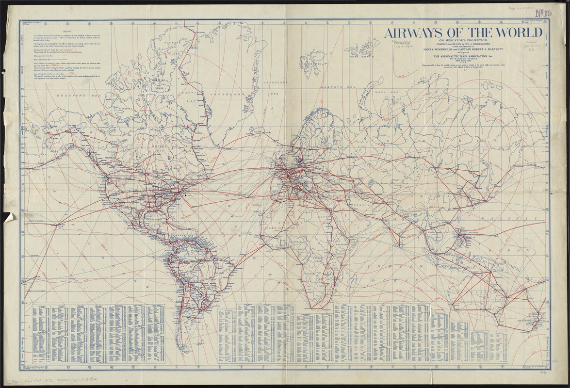
Airways of the world on Mercator's projection
Item Information
- Title:
- Airways of the world on Mercator's projection
- Creator:
- Briesemeister, William A.
- Name on Item:
-
compiled and drawn by Wm. A. Briesemeister.
- Date:
-
1919
- Format:
-
Maps/Atlases
- Location:
-
Boston Public Library
Norman B. Leventhal Map Center - Collection (local):
-
Norman B. Leventhal Map Center Collection
- Subjects:
-
Airways--Maps
World maps
- Places:
-
World
- Extent:
- 1 map : col. ; 64 x 98 cm.
- Terms of Use:
-
No known copyright restrictions.
No known restrictions on use.
- Publisher:
-
New York, N.Y :
Aeronautic Maps Assoc., Inc.
- Scale:
-
Scale [ca. 1:40,600,000] ;
- Language:
-
English
- Notes:
-
Includes table of the lengths of continental and intercontinental airways.
- Identifier:
-
06_01_008410
- Call #:
-
G3201.P62 1919 .B75
- Barcode:
-
39999065653782


