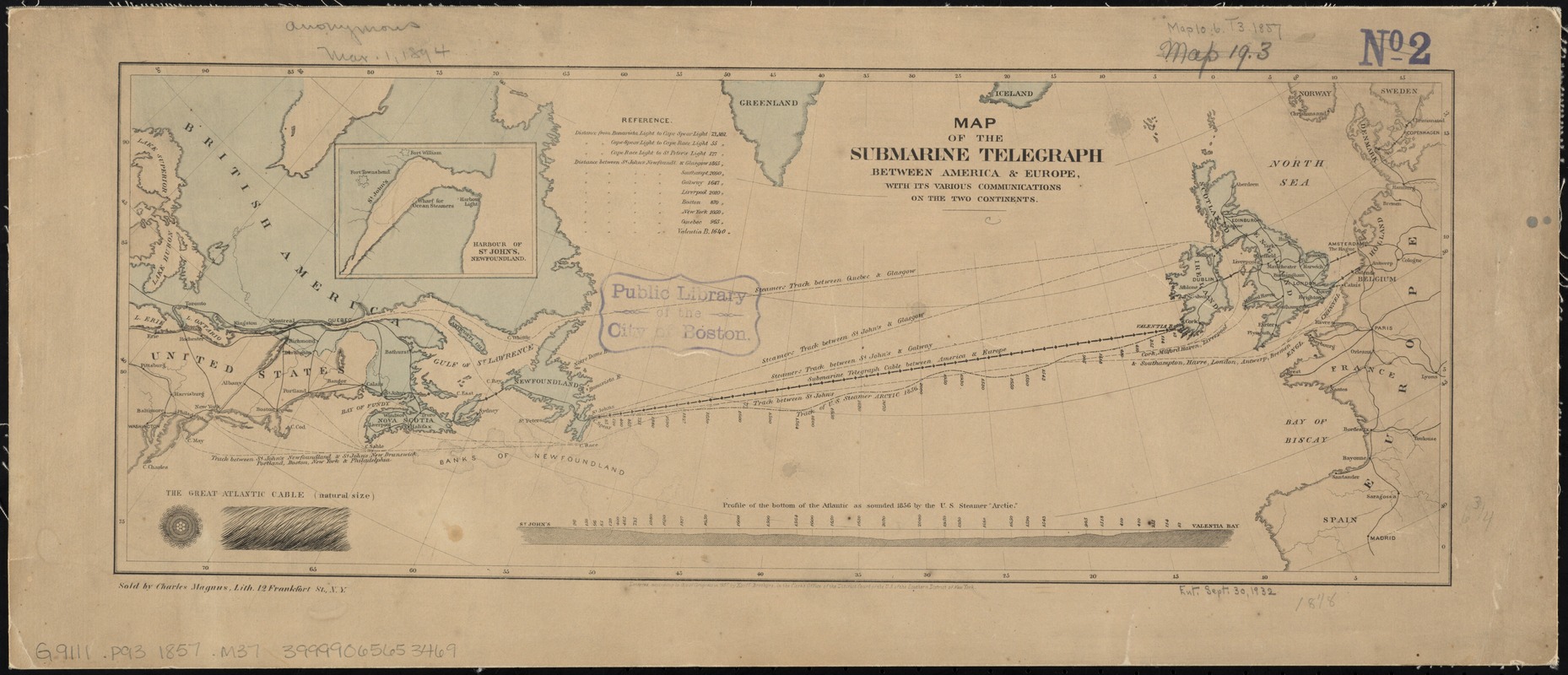
Map of the submarine telegraph between America & Europe, with its various communications on the two continents
Item Information
- Title:
- Map of the submarine telegraph between America & Europe, with its various communications on the two continents
- Date:
-
1857
- Format:
-
Maps/Atlases
- Location:
-
Boston Public Library
Norman B. Leventhal Map Center - Collection (local):
-
Norman B. Leventhal Map Center Collection
- Subjects:
-
Transatlantic cables--Maps
Telegraph lines--North America--Maps
Telegraph lines--Europe--Maps
North Atlantic Ocean--Maps
- Places:
-
Europe
North America (area)
Atlantic Ocean
Europe
- Extent:
- 1 map : col. ; 17 x 46 cm.
- Terms of Use:
-
No known copyright restrictions.
No known restrictions on use.
- Publisher:
-
New York :
Korff Brothers
- Scale:
-
Scale [ca. 1:10,000,000]
- Language:
-
English
- Notes:
-
Inset: Harbour of St. John's, Newfoundland.
Includes distance chart, "Profile of the bottom of the Atlantic as sounded 1856 by the U.S. Steamer 'Arctic,'" and ill. of the "Great Atlantic cable (natural size)."
"Sold by Charles Magnus."
"Entered accoring to Act of Congress in 1857 by Korff Brothers."
- Identifier:
-
06_01_008393
- Call #:
-
G9111.P93 1857 .M37
- Barcode:
-
39999065653469