Map of the world
Item Information
- Title:
- Map of the world
- Creator:
- Rand McNally and Company
- Name on Item:
-
by V. R. Exarch John Haddad, D. D.
- Date:
-
[1905]
- Format:
-
Maps/Atlases
- Location:
-
Boston Public Library
Norman B. Leventhal Map Center - Collection (local):
-
Norman B. Leventhal Map Center Collection
- Subjects:
-
World maps
- Places:
-
World
- Extent:
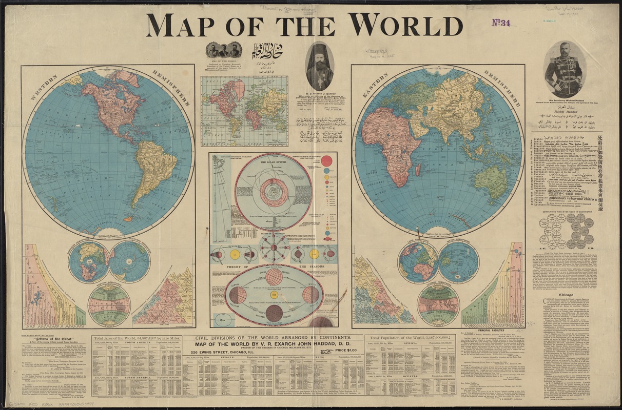
- 1 map : col. ; 2 hemispheres each 31 cm. in diameter, on sheet 74 x 112 cm.
- Terms of Use:
-
No known copyright restrictions.
No known restrictions on use.
- Publisher:
-
Chicago :
Rand McNally & Co.
- Scale:
-
Scale [ca. 1:65,000,000] at the equator
- Language:
-
English
- Notes:
-
Relief shown by hachures.
Ancillary maps: Northern hemisphere -- Southern hemisphere -- Western hemisphere [climate] -- World on Mercator's projection -- Land hemisphere -- Water hemisphere -- Eastern hemisphere [climate].
Includes 5 diagrams showing the comparative lengths of rivers, comparative heights of mountains, and comparative time.
Includes text and diagrams about the solar system and earth's orbit.
Includes portraits, text, "Letters of the Great," examples of languages spoken in the U.S., and table "Civil divisions of the world arranged by continents."
In English. Includes a passage in French and lines in other languages.
- Notes (date):
-
This date is inferred.
- Identifier:
-
06_01_008385
- Call #:
-
G3200 1905 .R35x
- Barcode:
-
39999065653394


