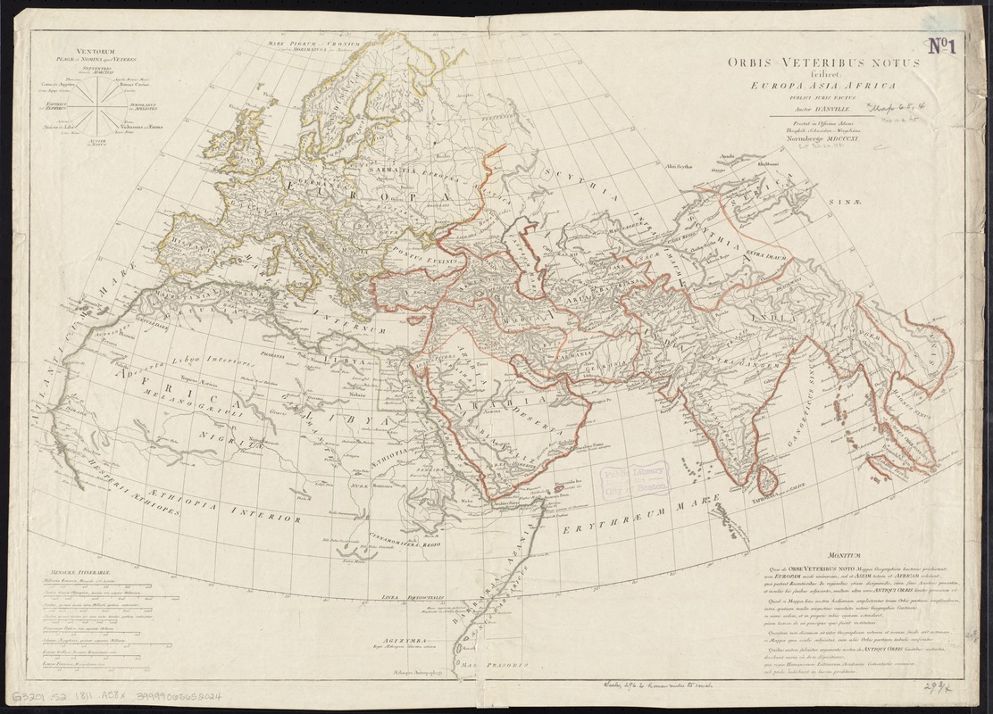
Orbis veteribus notus scilicet: Europe, Asia, Africa publici juris factus
Item Information
- Title:
- Orbis veteribus notus scilicet: Europe, Asia, Africa publici juris factus
- Creator:
- Anville, Jean Baptiste Bourguignon d', 1697-1782
- Name on Item:
-
auctor D'Anville.
- Date:
-
1811
- Format:
-
Maps/Atlases
- Location:
-
Boston Public Library
Norman B. Leventhal Map Center - Collection (local):
-
Norman B. Leventhal Map Center Collection
- Subjects:
-
Geography, Ancient--Maps
World maps
Eastern Hemisphere--Maps
- Places:
-
World
- Extent:
- 1 map : hand col. ; 53 x 76 cm.
- Terms of Use:
-
No known copyright restrictions.
No known restrictions on use.
- Publisher:
-
Norimbergae :
Officina Adami Theophili Schneideri-Weigeliana
- Scale:
-
Scale [ca. 1:19,000,000]
- Language:
-
Latin
- Notes:
-
Relief shown pictorially.
Includes a diagram of wind directions.
Prime meridian: Ferro.
In Latin.
- Identifier:
-
06_01_008368
- Call #:
-
G3201.S2 1811 .A58x
- Barcode:
-
39999065652024
![The World, on the globular projection with a graduation for the measurement of distances especially adapted for the use oe [sic] schools, geographical & historical lectures, and missionary meetings](https://bpldcassets.blob.core.windows.net/derivatives/images/commonwealth:ww72bp12b/image_thumbnail_300.jpg)


