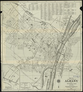
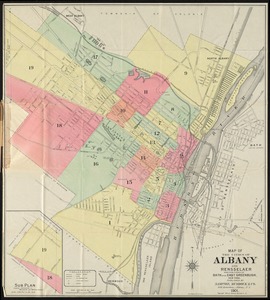
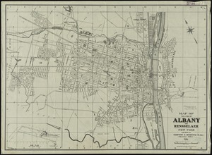
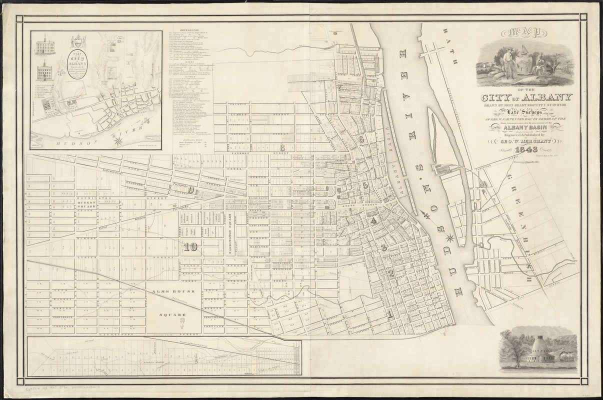
Map of the city of Albany
Item Information
- Title:
- Map of the city of Albany
- Creator:
- Bradt, John.
- Name on Item:
-
drawn by John Bradt Esqr., city surveyor, from the late surveys of Geo. W. Carpenter Esqr., by order of the State Commissioners for the assessment of the Albany Basin ; improvements, engraved & published by Geo. W. Merchant.
- Date:
-
1843
- Format:
-
Maps/Atlases
- Location:
-
Boston Public Library
Norman B. Leventhal Map Center - Collection (local):
-
Norman B. Leventhal Map Center Collection
- Subjects:
-
Albany (N.Y.)--Maps
Albany (N.Y.)--Administrative and political divisions--Maps
- Places:
-
Albany (county)Albany
- Extent:
- 1 map : 72 x 112 cm.
- Terms of Use:
-
No known copyright restrictions.
No known restrictions on use.
- Publisher:
-
[Albany?] :
Geo. W. Merchant
- Scale:
-
Scale [ca. 1:4,800]
- Language:
-
English
- Notes:
-
Oriented with north to upper left.
Shows wards, basin assessment numbers, streets, and railroads.
Includes references and 2 vignettes.
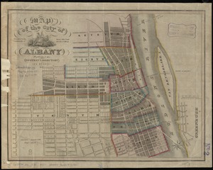
Insets: A plan of the city of Albany : surveyed at the request of the mayor, aldermen, and commonalty / by Simeon De Witt, 1794 -- [Continuation to the left].
- Identifier:
-
06_01_008351
- Call #:
-
G3804.A3 1843 .B73x
- Barcode:
-
39999065652115