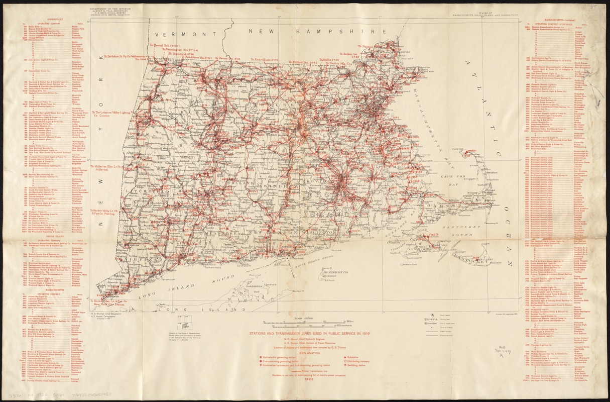
Stations and transmission lines used in public service in 1919 : [Massachusetts, Rhode Island, and Connecticut]
Item Information
- Title:
- Stations and transmission lines used in public service in 1919 : [Massachusetts, Rhode Island, and Connecticut]
- Upper right margin title :
- States of Massachusetts, Rhode Island and Connecticut
- Creator:
- Geological Survey (U.S.)
- Name on Item:
-
Department of the Interior, U.S. Geological Survey ; compiled by G.D. Thomas.
- Date:
-
1922
- Format:
-
Maps/Atlases
- Location:
-
Boston Public Library
Norman B. Leventhal Map Center - Collection (local):
-
Norman B. Leventhal Map Center Collection
- Subjects:
-
Power-plants--Massachusetts--Maps
Electric lines--Massachusetts--Maps
Electric power transmission--Massachusetts--Maps
Power-plants--Connecticut--Maps
Electric lines--Connecticut--Maps
Electric power transmission--Connecticut--Maps
Power-plants--Rhode Island--Maps
Electric lines--Rhode Island--Maps
Electric power transmission--Rhode Island--Maps
1919
- Places:
-
Massachusetts
Rhode Island
Connecticut
- Extent:
- 1 map : col. ; on sheet 47 x 69 cm.
- Terms of Use:
-
No known copyright restrictions.
No known restrictions on use.
- Publisher:
-
[Washington, D.C.] :
Geological Survey
- Scale:
-
Scale 1:500,000
- Language:
-
English
- Notes:
-
Shows power plants and transmission lines.
Includes index of power stations.
- Identifier:
-
06_01_008311
- Call #:
-
G3761.N4 1922 .G46x
- Barcode:
-
39999065651935


