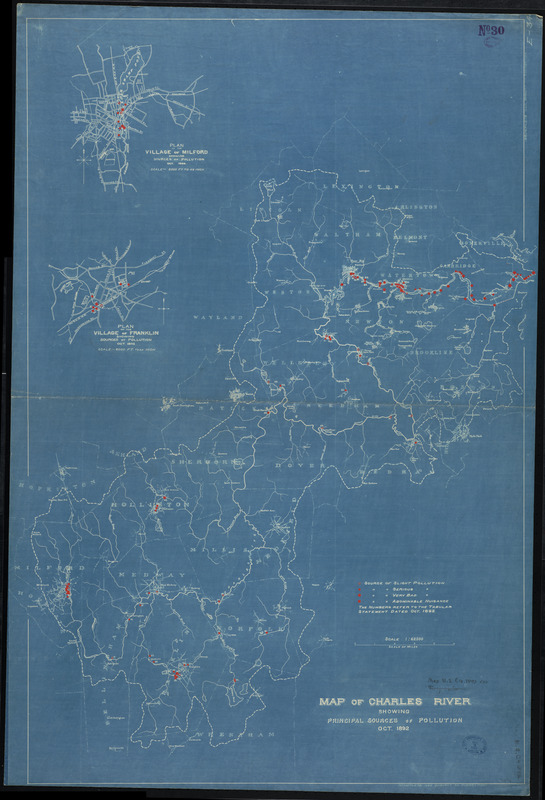
Map of Charles River showing principal sources of pollution
Item Information
- Title:
- Map of Charles River showing principal sources of pollution
- Description:
-
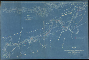
Crossing Boundaries exhibition: The 1892 blueprint map by the Boston Engineering Department takes an analytical approach, pinpointing sources of pollution of the Charles River and grading them from “Serious” to “Abominable Nuisance.” Today, a concerted cleanup effort has led to a rating by the Environmental Protection Agency of “A-minus,” and plans for a swimming venue on the Charles are underway.
- Cartographer:
- Boston (Mass.). Engineering Dept
- Date:
-
1892
- Format:
-
Maps/Atlases
- Location:
-
Boston Public Library
Norman B. Leventhal Map Center - Collection (local):
-
Norman B. Leventhal Map Center Collection
- Subjects:
-
Water--Pollution
Pollution--Massachusetts--Charles River--Maps
Charles River (Mass.)--Maps
- Places:
-
Charles (river)
- Extent:
- 1 map : blueprint ; 99 x 69 cm
- Terms of Use:
-
No known copyright restrictions.
No known restrictions on use.
- Publisher:
-
Boston, Mass. :
City Engineer's Office
- Scale:
-
Scale 1:62,500
- Language:
-
English
- Notes:
-
Blueprint maps showing severity of sources of pollution.
Accompanied by Tabular statement (5 blueprint sheets) listing details of pollution sources marked on maps.
- Notes (exhibitions):
-
Exhibited: "Crossing Boundaries: Art // Maps" organized by the Norman B. Leventhal Map & Education Center at the Boston Public Library, 2018-2019.
- Identifier:
-
06_01_008291
- Call #:
-
G3762.C5N856 1892 .B67x
- Barcode:
-
39999065651760