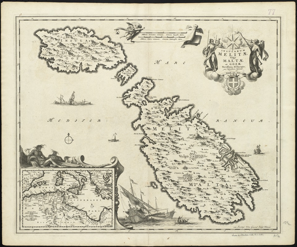
Insularum Melitae vulgo Maltae et Gozae
Item Information
- Title:
- Insularum Melitae vulgo Maltae et Gozae
- Title (alt.):
-
Collection of old maps
- Creator:
- Visscher, Nicolaes, 1649-1702
- Name on Item:
-
novissima delineato per Nicolaum Visscher.
- Date:
-
[1698?]
- Format:
-
Maps/Atlases
- Location:
-
Boston Public Library
Norman B. Leventhal Map Center - Collection (local):
-
Norman B. Leventhal Map Center Collection
- Subjects:
-
Malta--Maps--Early works to 1800
Gozo Island (Malta)--Maps--Early works to 1800
- Places:
-
Malta
- Extent:
- 1 map ; 45 x 55 cm.
- Terms of Use:
-
No known copyright restrictions.
No known restrictions on use.
- Publisher:
-
Amstelodami :
N. Visscher
- Scale:
-
Scale [ca. 1:150,000]
- Language:
-
Latin
- Notes:
-
Map of the Republic of Malta.
Date from Koeman, v. 5, p. 200.
Relief shown pictorially.
Includes inset: Maris Mediterranei pars.
"Cum privilegio Ordin. General. Belgii Foederati."
Cataloging, conservation, and digitization made possible in part by The National Endowment for the Humanities: Exploring the human endeavor.
Part of composite portfolio atlas with title "Collection of old maps."
- Identifier:
-
06_01_009992
- Call #:
-
G1015 .C651 1630
- Barcode:
-
30000003921091