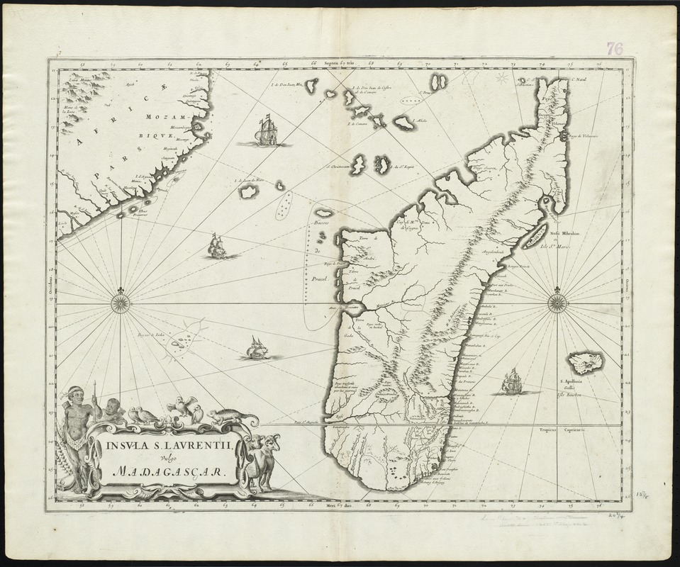
Insula S. Laurentii, vulgo Madagascar
Item Information
- Title:
- Insula S. Laurentii, vulgo Madagascar
- Title (alt.):
-
Insula Sancti Laurentii
Collection of old maps
- Creator:
- Blaeu, Joan, 1596-1673
- Date:
-
[1662–1670]
- Format:
-
Maps/Atlases
- Location:
-
Boston Public Library
Norman B. Leventhal Map Center - Collection (local):
-
Norman B. Leventhal Map Center Collection
- Subjects:
-
Madagascar--Maps--Early works to 1800
Mozambique--Maps--Early works to 1800
- Places:
-
Madagascar
Mozambique
- Extent:
- 1 map ; 43 x 55 cm.
- Terms of Use:
-
No known copyright restrictions.
No known restrictions on use.
- Publisher:
-
Amsterdam :
J. Blaeu
- Scale:
-
Scale [ca. 1:4,200,000]
- Language:
-
Latin
- Notes:
-
Map of Madagascar and the coast of Mozambique.
Relief shown pictorially.
Map displays navigation hazards.
Includes two compass roses and a decorative tile cartouche with natives and local fauna.
Verso is blank.
Cataloging, conservation, and digitization made possible in part by The National Endowment for the Humanities: Exploring the human endeavor.
Part of composite portfolio atlas with title "Collection of old maps."
- Notes (date):
-
This date is inferred.
- Identifier:
-
06_01_009986
- Call #:
-
G1015 .C651 1630
- Barcode:
-
30000003920116


