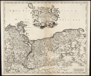
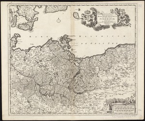
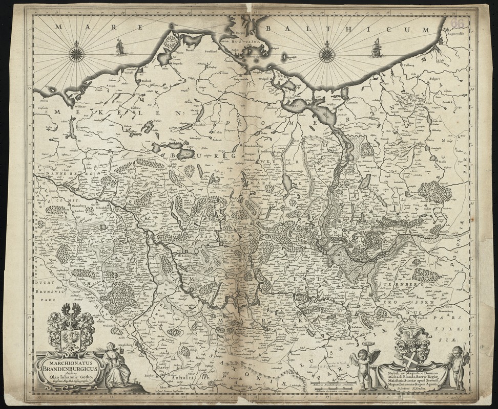
Marchionatus Brandenburgicus
Item Information
- Title:
- Marchionatus Brandenburgicus
- Title (alt.):
-
Collection of old maps
- Creator:
- Gothus, Olaus Joannis, 1600-1644
- Name on Item:
-
authore Olao Johannis Gotho ; Apud Joannem Janssonium.
- Date:
-
1641
- Format:
-
Maps/Atlases
- Location:
-
Boston Public Library
Norman B. Leventhal Map Center - Collection (local):
-
Norman B. Leventhal Map Center Collection
- Subjects:
-
Brandenburg (Germany)--Maps--Early works to 1800
Pomerania (Poland and Germany)--Maps--Early works to 1800
Poland--Maps--Early works to 1800
- Places:
-
GermanyBrandenburg
Pomerania (area)
Poland
- Extent:
- 1 map ; 46 x 53 cm.
- Terms of Use:
-
No known copyright restrictions.
No known restrictions on use.
- Publisher:
-
Amsterdam :
Jansson
- Scale:
-
Scale [ca. 1:800,000]
- Language:
-
Latin
- Notes:
-
Map of the historical regions of Brandenburg and Pomerania in northern Germany and Poland.
Relief shown pictorially.
Included dedication to Michael Blondus, Swedish ambassador in London, by H. Hondius.
In Latin.
Cataloging, conservation, and digitization made possible in part by The National Endowment for the Humanities: Exploring the human endeavor.
Part of composite portfolio atlas with title "Collection of old maps."
- Identifier:
-
06_01_009965
- Call #:
-
G1015 .C651 1630
- Barcode:
-
30000003915838