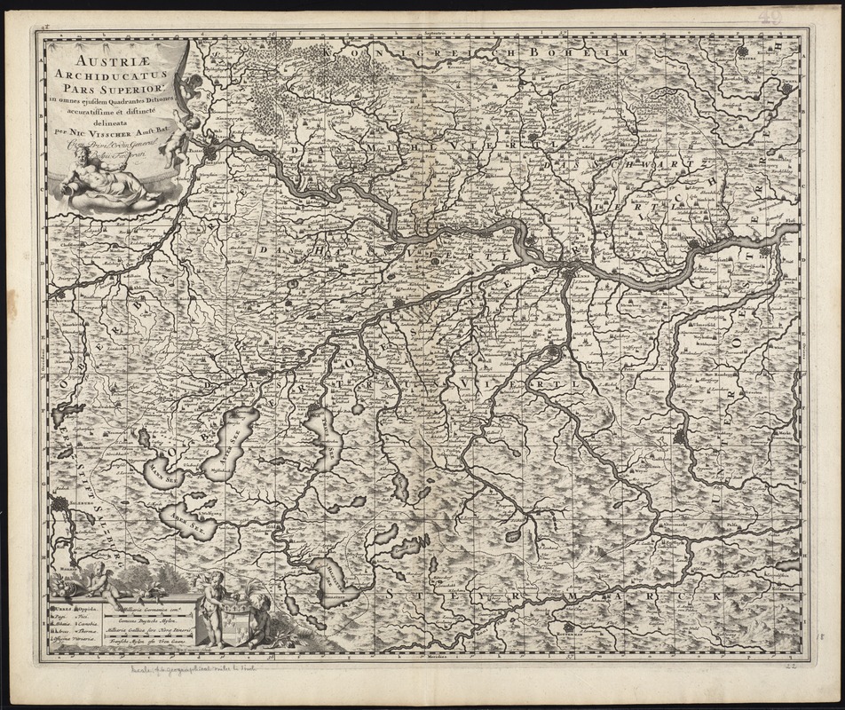
Austriae archiducatus pars superior in omnes ejusdem quadrantes ditiones accuratissime et distincte delineata
Item Information
- Title:
- Austriae archiducatus pars superior in omnes ejusdem quadrantes ditiones accuratissime et distincte delineata
- Title (alt.):
-
Collection of old maps
- Creator:
- Visscher, Nicolaes, 1649-1702
- Name on Item:
-
per Nic. Visscher.
- Date:
-
[1698]
- Format:
-
Maps/Atlases
- Location:
-
Boston Public Library
Norman B. Leventhal Map Center - Collection (local):
-
Norman B. Leventhal Map Center Collection
- Subjects:
-
Austria--Maps--Early works to 1800
- Places:
-
Austria
- Extent:
- 1 map ; 46 x 56 cm.
- Terms of Use:
-
No known copyright restrictions.
No known restrictions on use.
- Publisher:
-
Amsterdam :
N. Visscher
- Scale:
-
Scale [ca. 1:335,000]
- Language:
-
Latin
- Notes:
-
Map of the upper part of the historical Archduchy of Austria.
Relief shown pictorially.
G.V. Gouwen sc.
Cataloging, conservation, and digitization made possible in part by The National Endowment for the Humanities: Exploring the human endeavor.
Part of composite portfolio atlas with title "Collection of old maps."
- Notes (date):
-
This date is inferred.
- Identifier:
-
06_01_009914
- Call #:
-
G1015 .C651 1630
- Barcode:
-
30000003908836