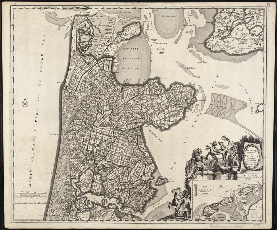
Hollandiae septentrionalis & Frisiae occidentalis accuratissima delineatio
Item Information
- Title:
- Hollandiae septentrionalis & Frisiae occidentalis accuratissima delineatio
- Title (alt.):
-
Collection of old maps
- Creator:
- Ram, Johannes de, 1648-1693
- Name on Item:
-
auctore Johanne de Ram.
- Date:
-
[ca. 1690]
- Format:
-
Maps/Atlases
- Location:
-
Boston Public Library
Norman B. Leventhal Map Center - Collection (local):
-
Norman B. Leventhal Map Center Collection
- Subjects:
-
Netherlands--Maps--Early works to 1800
North Holland (Netherlands)--Maps--Early works to 1800
- Places:
-
Netherlands
- Extent:
- 1 map ; 50 x 58 cm.
- Terms of Use:
-
No known copyright restrictions.
No known restrictions on use.
- Publisher:
-
Amstelodami :
[Johannes de Ram]
- Scale:
-
Scale [ca. 1:150,000]
- Language:
-
Latin
- Notes:
-
Map of the Province of North Holland.
Relief shown pictorially.
Inset: Insulae adjacentes Texel, Vlieland, & Schelling.
Elaborately engraved cartouche surrounds inset map.
Cum Privilegio Ordinum Hollandiae et Westfrisiae.
Cataloging, conservation, and digitization made possible in part by The National Endowment for the Humanities: Exploring the human endeavor.
Part of composite portfolio atlas with title "Collection of old maps."
- Identifier:
-
06_01_009526
- Call #:
-
G1015 .C651 1630
- Barcode:
-
30000003862871