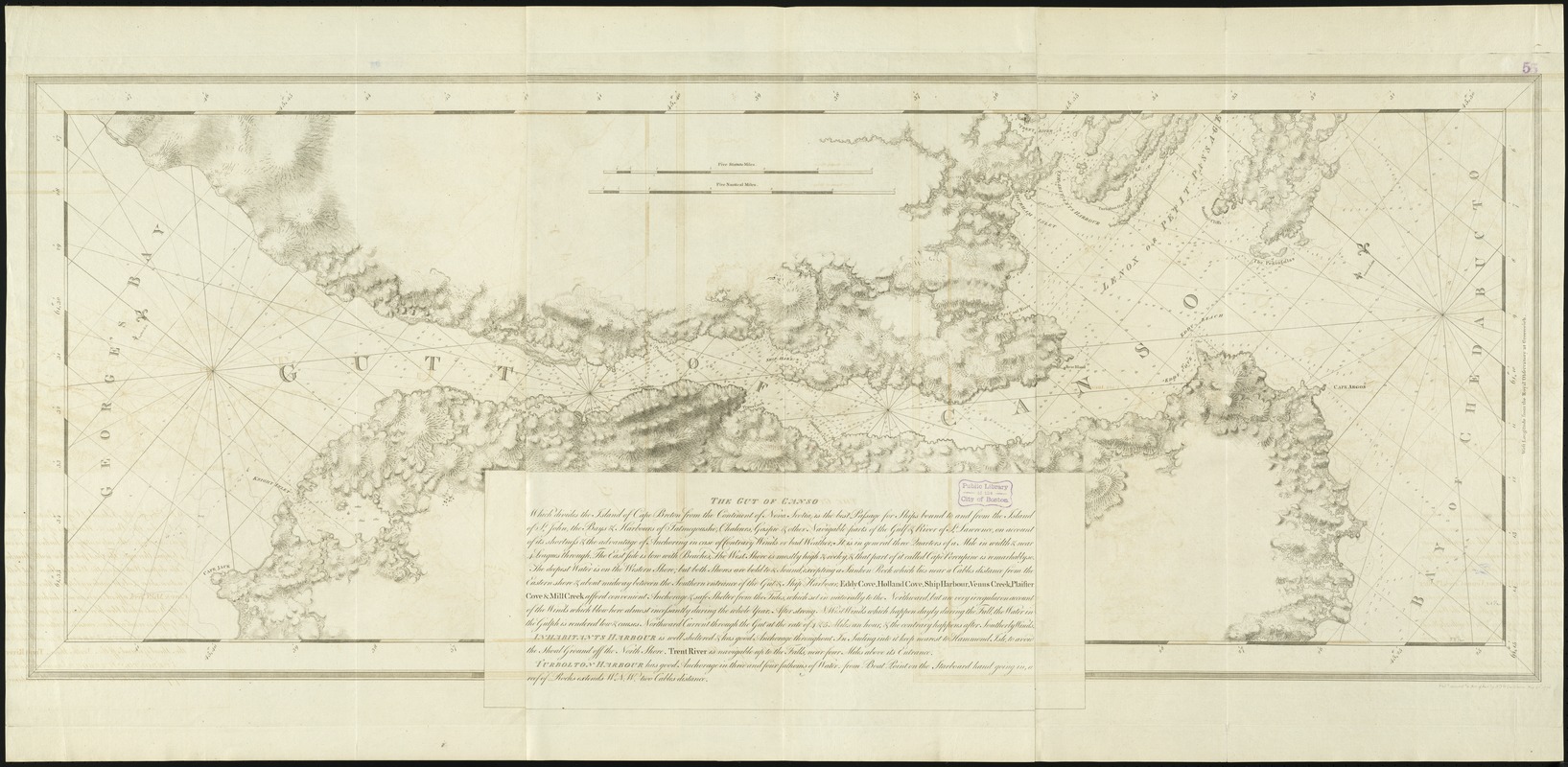
The Gut of Canso : which divides ... cables distance
This map is also available in American Revolutionary Geographies Online (ARGO), a collections portal especially built for material relating to the American Revolutionary War Era. Visit ARGO to learn more about this item and explore the historical geography of North America in the late eighteenth century.
Item Information
- Title:
- The Gut of Canso : which divides ... cables distance
- Creator:
- Des Barres, Joseph F. W. (Joseph Frederick Wallet), 1722-1824
- Date:
-
1776
- Format:
-
Maps/Atlases
- Location:
-
Boston Public Library
Norman B. Leventhal Map Center - Collection (local):
-
Norman B. Leventhal Map Center Collection
- Subjects:
-
Nautical charts--Nova Scotia--Canso, Strait of--Early works to 1800
Nautical charts--Nova Scotia--Early works to 1800
Coasts--Nova Scotia--Maps--Early works to 1800
Nova Scotia--Maps--Early works to 1800
Canso, Strait of (N.S.)--Maps--Early works to 1800
- Places:
-
CanadaCanso, Strait of
- Extent:
- 1 chart ; 55 x 149 cm.
- Terms of Use:
-
No known copyright restrictions.
No known restrictions on use.
- Publisher:
-
[London] :
Pubd. accordg. to Act of Parlt. by J.F.W. Des Barres
- Scale:
-
Scale [ca. 1:28,000]
- Language:
-
English
- Notes:
-
Chart of the Strait of Canso, from Cape Argos to Cape Jack on George Bay.
Depths shown by soundings.
Oriented with north toward the upper left.
Appears in the author's Atlantic Neptune. London : J.F.W. Des Barres, 1777-[1781].
- Identifier:
-
06_01_008294
- Call #:
-
G1106.P5 D47 1777
- Barcode:
-
30000003798481


