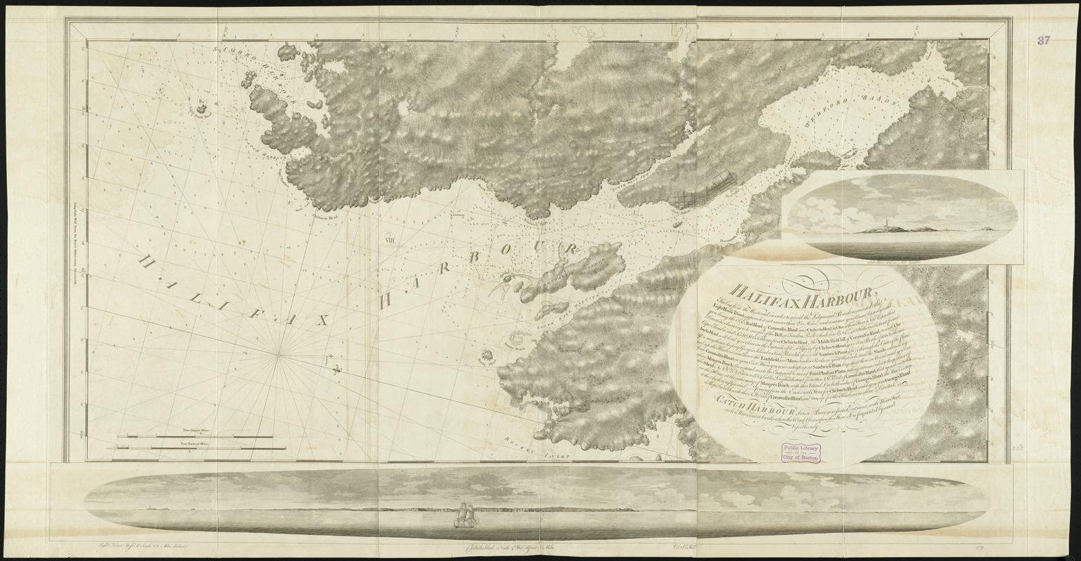
Halifax Harbour ... Catch Harbour ... small vessels only
This map is also available in American Revolutionary Geographies Online (ARGO), a collections portal especially built for material relating to the American Revolutionary War Era. Visit ARGO to learn more about this item and explore the historical geography of North America in the late eighteenth century.
Item Information
- Title:
- Halifax Harbour ... Catch Harbour ... small vessels only
- Creator:
- Des Barres, Joseph F. W. (Joseph Frederick Wallet), 1722-1824
- Date:
-
[1776]
- Format:
-
Maps/Atlases
- Location:
-
Boston Public Library
Norman B. Leventhal Map Center - Collection (local):
-
Norman B. Leventhal Map Center Collection
- Subjects:
-
Nautical charts--Nova Scotia--Bedford Bay--Early works to 1800
Nautical charts--Nova Scotia--Halifax Harbour--Early works to 1800
Nautical charts--Nova Scotia--Early works to 1800
Coasts--Nova Scotia--Maps--Early works to 1800
Halifax Harbour (N.S.)--Maps--Early works to 1800
Bedford Bay (N.S.)--Maps--Early works to 1800
Nova Scotia--Maps--Early works to 1800
- Places:
-
CanadaNova Scotia (province)Halifax Harbour (harbor)
Bedford Bay
- Extent:
- 1 chart ; 62 x 128 cm, on sheet 79 x 151 cm.
- Terms of Use:
-
No known copyright restrictions.
No known restrictions on use.
- Publisher:
-
London :
J.F.W. Des Barres
- Edition:
- 2nd state.
- Scale:
-
Scale [ca. 1:30,000]
- Language:
-
English
- Notes:
-
Chart of the area from Cole Harbor to Sambro Harbor, and inland to the head of Bedford Basin.
Depths shown by soundings.
Oriented with north toward the lower right.
Insets: Light house S.E. one mile distant ; [Panorama of the entrance to Halifax Harbor].
Appears in the author's Atlantic Neptune. London : J.F.W. Des Barres, 1777-[1781].
- Notes (date):
-
This date is inferred.
- Identifier:
-
06_01_008280
- Call #:
-
G1106.P5 D47 1777
- Barcode:
-
30000003797519


