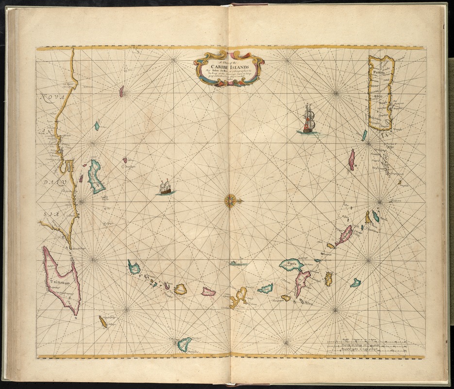
A chart of the Caribe islands
Item Information
- Title:
- A chart of the Caribe islands
- Creator:
- Seller, John, fl. 1658-1698
- Name on Item:
-
by John Seller.
- Date:
-
[1672?]
- Format:
-
Maps/Atlases
- Location:
-
Boston Public Library
Norman B. Leventhal Map Center - Collection (local):
-
Norman B. Leventhal Map Center Collection
- Subjects:
-
Nautical charts--Antilles, Lesser--Early works to 1800
Antilles, Lesser--Maps--Early works to 1800
- Places:
-
Lesser Antilles (area)
- Extent:
- 1 map : hand col. ; 42 x 54 cm.
- Terms of Use:
-
No known copyright restrictions.
No known restrictions on use.
- Publisher:
-
London :
John Seller
- Scale:
-
Scale [ca. 1:2,150,000]
- Language:
-
English
- Notes:
-
Oriented with north to the right.
Map of Puerto Rico, the Lesser Antilles, and the northern coast of South America.
Appears in the author's Atlas maritimus, or A book of charts. London : John Seller, [1672?].
Cataloging, conservation, and digitization made possible in part by The National Endowment for the Humanities: Exploring the human endeavor.
Atlas scanned by Internet Archive http://archive.org/details/atlasmaritimusor00sell
- Identifier:
-
06_01_007938
- Call #:
-
G1059 .S45 1672
- Barcode:
-
30000003777907

![[Alleen de Caribische Eilanden, vervat in 't groot]](https://bpldcassets.blob.core.windows.net/derivatives/images/commonwealth:st74cw59p/image_thumbnail_300.jpg)

