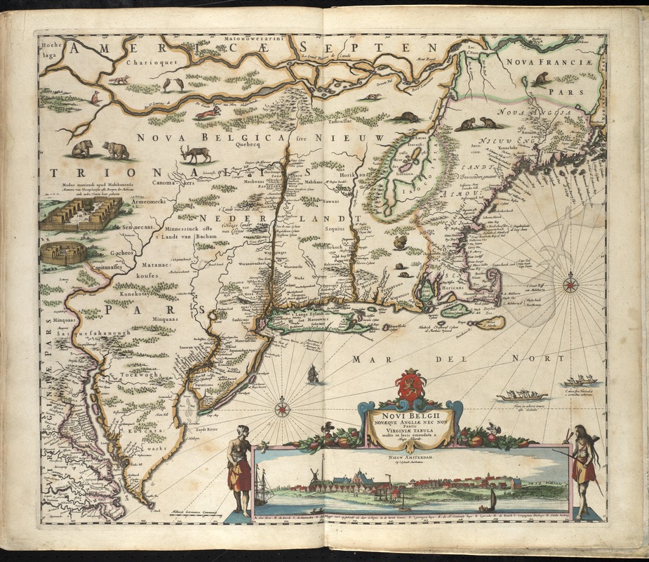
Noui Belgii Nouaeque Angliae nec non partis Virginiae tabula
Item Information
- Title:
- Noui Belgii Nouaeque Angliae nec non partis Virginiae tabula
- Title (alt.):
-
Novi Belgii Novaeqve Angliae nec non partis Virginiae tabula
- Creator:
- Allard, Huych, 1625-1691
- Name on Item:
-
multis in locis emendata a Hugo Allardt.
- Date:
-
[1660]
- Format:
-
Maps/Atlases
- Location:
-
Boston Public Library
Norman B. Leventhal Map Center - Collection (local):
-
Norman B. Leventhal Map Center Collection
- Subjects:
-
Northeastern States--Maps--Early works to 1800
New England--Maps--Early works to 1800
Middle Atlantic States--Maps--Early works to 1800
- Places:
-
New England (area)
Northeastern United States (area)
Middle Atlantic (area)
- Extent:
- 1 map : col. ; 46 x 54 cm.
- Terms of Use:
-
No known copyright restrictions.
No known restrictions on use.
- Publisher:
-
Amsterdam :
hendrick Doncker
- Scale:
-
Scale [ca. 1:2,300,000].
- Language:
-
Latin
Dutch
- Notes:
-
Relief shown pictorially.
Includes N. Visscher's view of Nieuw Amsterdam.
Appears in Hendrick Doncker's De zee-atlas of Water-waerelt, vertoonende alle de zee-kusten van het bekende des aerd-bodems, met een generale beschrijvinge van dien ... Amsterdam: Hendrick Doncker, 1660 [i.e. 1665].
Cataloging, conservation, and digitization made possible in part by The National Endowment for the Humanities: Exploring the human endeavor.
Atlas scanned by Internet Archive http://archive.org/details/dezeeatlasofwate00donc
- Notes (date):
-
This date is inferred.
- Identifier:
-
06_01_007888
- Call #:
-
G1059 .D66 1665
- Barcode:
-
30000003765893


