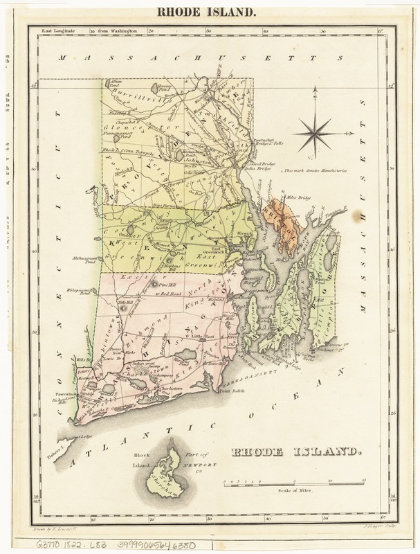
Geographical, statistical, and historical map of Rhode Island
Item Information
- Title:
- Geographical, statistical, and historical map of Rhode Island
- Title on map in smaller type :
- Rhode Island
- Title (uniform):
-
Complete historical, chronological, and geographical American atlas
- Creator:
- Lucas, Fielding, 1781-1854
- Name on Item:
-
drawn by F. Lucas, Jr. ; J. Yeager sculp.
- Date:
-
[1822]
- Format:
-
Maps/Atlases
- Location:
-
Boston Public Library
Norman B. Leventhal Map Center - Collection (local):
-
Norman B. Leventhal Map Center Collection
- Subjects:
-
Rhode Island--Maps
Rhode Island--Description and travel
Rhode Island--History
- Places:
-
Rhode Island
- Extent:
- 1 map : hand col. ; 28 x 20 cm., on sheet 45 x 56 cm.
- Terms of Use:
-
No known copyright restrictions.
No known restrictions on use.
- Publisher:
-
Philadelphia :
H.C. Carey and I. Lea
- Scale:
-
Scale [ca. 1:380,000]
- Language:
-
English
French
- Notes:
-
Relief shown by hachures.
Title from upper margin.
Prime meridian: Washington.
Border of map contains extensive text on the geography and history of Rhode Island, including chronological list of governors.
From: A complete historical, chronological, and geographical American atlas. Philadelphia : H.C. Carey and I. Lea, 1822.
In upper right margin: No. 13.
Leventhal Map Center copy gift of Bank of America.
- Notes (date):
-
This date is inferred.
- Identifier:
-
06_01_007647
- Call #:
-
G3770 1822 .L83
- Barcode:
-
39999065646380


