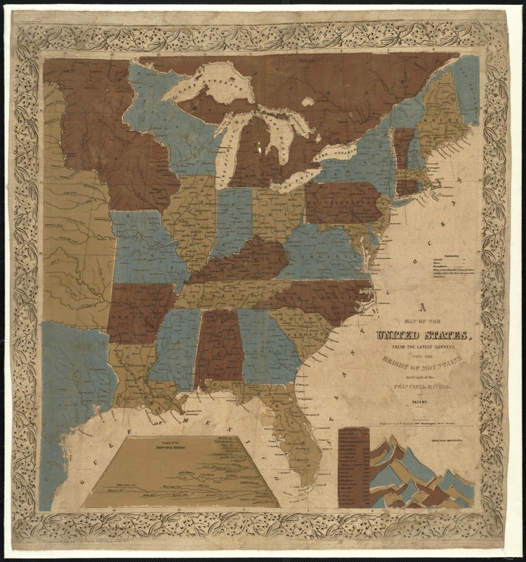
Map of the United States, from the latest surveys : with the heights of mountains and length of the principle rivers
Item Information
- Title:
- Map of the United States, from the latest surveys : with the heights of mountains and length of the principle rivers
- Creator:
- Boynton, George W., d. 1884
- Name on Item:
-
engraved by G.W. Boynton ... Boston.
- Date:
-
[ca. 1841]
- Format:
-
Maps/Atlases
- Location:
-
Boston Public Library
Norman B. Leventhal Map Center - Collection (local):
-
Norman B. Leventhal Map Center Collection
- Subjects:
-
United States--Maps
- Places:
-
- Extent:
- 1 map : col., cloth ; 58 x 54 cm.
- Terms of Use:
-
No known copyright restrictions.
No known restrictions on use.
- Publisher:
-
Boston, Mass :
J.W. Tuttle
- Scale:
-
Scale [ca. 1:4,800,000]
- Language:
-
English
- Notes:
-
Entered according of act of Congress in the year of 1841 by the Tremont Print Company in the Clerk's Office in the District Court of Massachusetts.
Cloth map.
Includes inset "Length of the principal rivers and indexed inset of "Principal mountains."
- Identifier:
-
06_01_007630
- Call #:
-
G3700 1841 .B69
- Barcode:
-
39999065645630
- LCCN:
-
96688044


