Middlesex Fells Reservation
Item Information
- Title:
- Middlesex Fells Reservation
- Description:
-
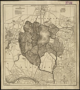
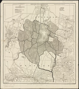
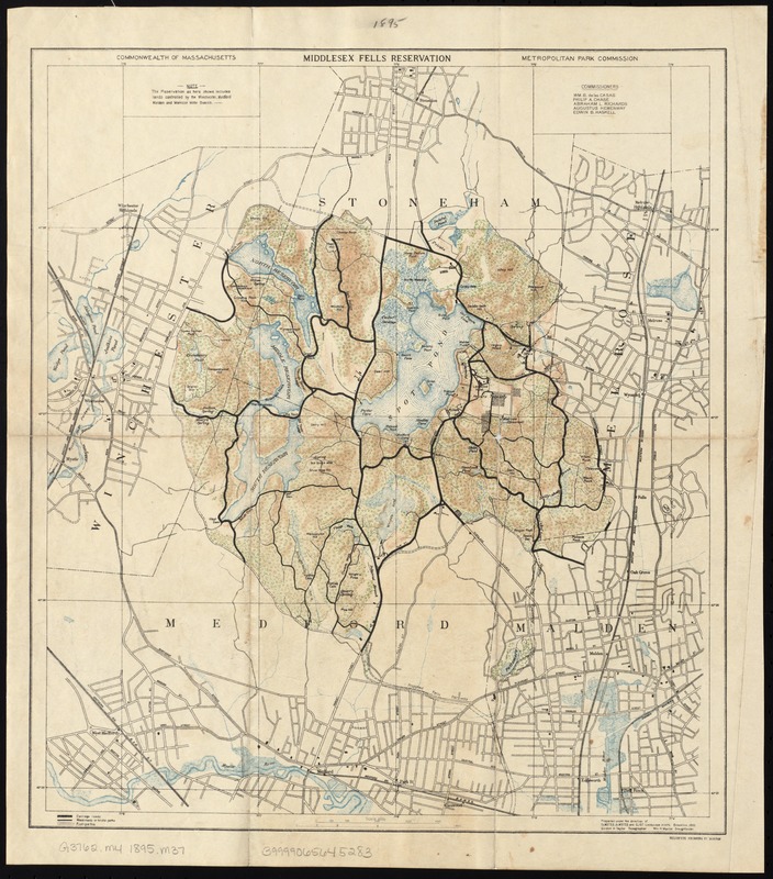
Designed by the firm of Olmsted, OImsted, and Eliot, Middlesex Fells was among the four reservations that comprised the original Metropolitan Parks System, along with Beaver Brook, Stony Brook, and the Blue Hills. Charles Eliot used the Fells—which encompassed parts of Malden, Medford, Winchester, Stoneham, and Melrose—to demonstrate the need for a regional park system; no single community could protect the entire reservation. This topographic map illustrates the varied landscape that delighted Eliot, who wrote fondly of the reservation, “Here is a cliff and a cascade, here a pool, pond, or stream, here a surprising glimpse of a fragment of blue ocean...”
- Creator:
- Massachusetts. Metropolitan Park Commission
- Name on Item:
-
Commonwealth of Massachusetts, Metropolitan Park Commission.
- Date:
-
[1895]
- Format:
-
Maps/Atlases
- Location:
-
Boston Public Library
Norman B. Leventhal Map Center - Collection (local):
-
Norman B. Leventhal Map Center Collection
- Subjects:
-
Recreation areas--Massachusetts
Middlesex Fells Reservation (Mass.)--Maps
- Places:
-
Middlesex (county)Middlesex Fells (area)
- Extent:
- 1 map : col. ; 39 x 35 cm.
- Terms of Use:
-
No known copyright restrictions.
No known restrictions on use.
- Publisher:
-
Boston :
The Commission
- Scale:
-
Scale 1:20,000.
- Language:
-
English
- Notes:
-
From: Public document No. 48. Report of the Board of Metropolitan Park Commissioners, January 1896.
"Prepared under the direction of Olmsted, Olmsted and Eliot, Landscape Archts, Brookline, 1895. Gordon H. Taylor, Topographer ; Wm. H. Munroe, Draughtsman."
- Notes (date):
-
This date is inferred.
- Notes (exhibitions):
-
Exhibited: "Breathing Room: Mapping Boston's Green Spaces" organized by the Norman B. Leventhal Map Center at the Boston Public Library, 2018.
- Identifier:
-
06_01_007547
- Call #:
-
G3762.M4 1895 .M37
- Barcode:
-
39999065645283