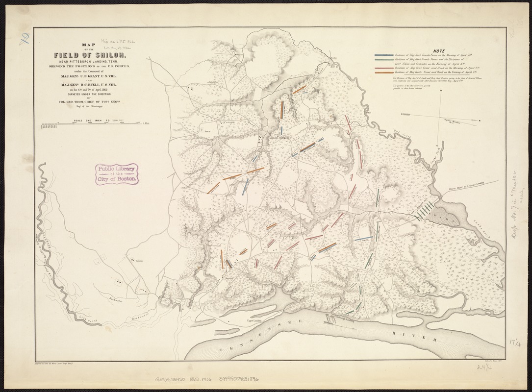
Map of the field of Shiloh, near Pittsburgh Landing, Tenn., shewing the positions of the U.S. forces under the command of Maj. Genl. U. S. Grant, U.S. Vol. and Maj. Genl. D. C. Buell, U.S. Vol. on the 6th and 7th of April 1862
Item Information
- Title:
- Map of the field of Shiloh, near Pittsburgh Landing, Tenn., shewing the positions of the U.S. forces under the command of Maj. Genl. U. S. Grant, U.S. Vol. and Maj. Genl. D. C. Buell, U.S. Vol. on the 6th and 7th of April 1862
- Creator:
- Matz, Otto H., 1830-1919
- Name on Item:
-
surveyed under the direction of Col. Geo. Thom, Chief of Topl. Engrs., Dept. of the Mississippi ; drawn by Otto H. Matz, Asst. Topl. Engs.
- Date:
-
[1862]
- Format:
-
Maps/Atlases
- Location:
-
Boston Public Library
Norman B. Leventhal Map Center - Collection (local):
-
Norman B. Leventhal Map Center Collection
- Subjects:
-
Shiloh, Battle of, Tenn., 1862--Maps
Shiloh National Military Park (Tenn. and Miss.)--Maps
- Places:
-
Hardin (county)Shiloh National Military Park
- Extent:
- 1 map : col. ; 44 x 62 cm.
- Terms of Use:
-
No known copyright restrictions.
No known restrictions on use.
- Publisher:
-
N.Y :
Lith. of J. Bien
- Scale:
-
Scale 1:14,400. 1 in. to 1200 ft.
- Language:
-
English
- Notes:
-
Relief shown by hachures.
Shows vegetation, drainage, houses, and roads.
- Notes (date):
-
This date is inferred.
- Identifier:
-
06_01_007490
- Call #:
-
G3964.S54S5 1862 .M36
- Barcode:
-
39999059031896


