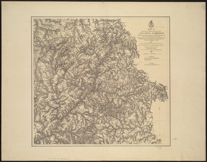
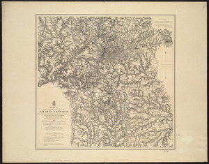
Map[s] illustrating the military operations of the Atlanta campaign ... 1864
![Map[s] illustrating the military operations of the Atlanta campaign ... 1864](https://bpldcassets.blob.core.windows.net/derivatives/images/commonwealth:3f463432v/image_access_800.jpg)
Item Information
- Title:
- Map[s] illustrating the military operations of the Atlanta campaign ... 1864
- Cartographer:
- United States. War Department. Office of the Chief of Engineers
- Name on Item:
-
compiled by authority of the Hon. the Secretary of War in the Office of the Chief of Engineers, U.S.A.
- Date:
-
1875
- Format:
-
Maps/Atlases
- Location:
-
Boston Public Library
Norman B. Leventhal Map Center - Collection (local):
-
Norman B. Leventhal Map Center Collection
- Subjects:
-
Atlanta Campaign, 1864--Maps
Landowners--Georgia--Maps
Georgia--History--Civil War, 1861-1865--Maps
- Places:
-
GeorgiaFulton (county)Atlanta
- Extent:
- 5 maps : col. ; 87 x 78 cm. or smaller, on sheet 96 x 89 cm. or smaller
- Terms of Use:
-
No known copyright restrictions.
No known restrictions on use.
- Publisher:
-
New York :
Am. Photo-Lithographic Co.
- Scale:
-
Scale approximately 1:85,000
- Language:
-
English
- Table of Contents:
-
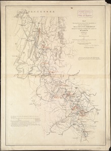
Map I. This map embraces the region extending from the Tennessee River to the Oostanaula River and exhibits the works of the United States and Confederate forces (1875)
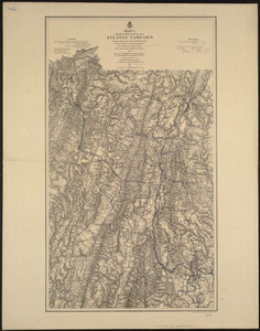
Map II. This map includes the region from Resaca on the north to Ackworth [sic] on the south and exhibits the works of the United States and Confederate forces (1877)
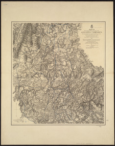
Map III. This map includes the region extending from Rome, Kingston, and Cassville on the north to include Dallas and Marietta on the south and exhibits the works of the United States and Confederate forces (1876)
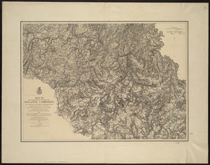
Map IV. Embracing the region from Pine, Lost, and Kennesaw Mountains south to include Atlanta and its environs, exhibiting the lines of operations at Pine, Lost, and Kennesaw Mts., at Smyrna Camp Ground along the Chattahoochie [sic] River, and in the investment of Atlanta (1874)
Map V. This map includes the region from the Chattahoochee River south to Jonesboro and Lovejoy's Station and exhibits the works of the United States and Confederate forces (1877)
- Notes:
-
Shows Union Army lines of march, dates, troop positions, and campsites in northwestern Georgia between Chattanooga and Atlanta.
Relief shown by hachures.
The coverage of these 5 maps is indicated on J.v. Glümer's Map illustrating the operations of the army under command of General W.T. Sherman, in Georgia, from May the 5th to September the 4th, 1864 (CW 127, S181).
Includes names of select landowners and list of authorities.
- Notes (citation):
-
LC Civil War maps (2nd ed.), 131, S200
- Identifier:
-
06_01_007493
06_01_007494
06_01_007495
06_01_007496
06_01_007497
- Call #:
-
G3921.S5 1864 .U55
- Barcode:
-
39999059031920