Lloyd's new military map of the border & southern states
Item Information
- Title:
- Lloyd's new military map of the border & southern states
- Creator:
- Hall, Edward S.
- Name on Item:
-
[Drawn by Edward S. Hall. Waters & Sons, engravers].
- Date:
-
1865
- Format:
-
Maps/Atlases
- Location:
-
Boston Public Library
Norman B. Leventhal Map Center - Collection (local):
-
Norman B. Leventhal Map Center Collection
- Subjects:
-
United States--History--Civil War, 1861-1865--Maps
- Places:
-
- Extent:
- 1 map : col. ; 76 x 106 cm.
- Terms of Use:
-
No known copyright restrictions.
No known restrictions on use.
- Publisher:
-
New York :
H.H. Lloyd & Co.
- Scale:
-
Scale ca. 1:850,000.
- Language:
-
English
- Notes:
-
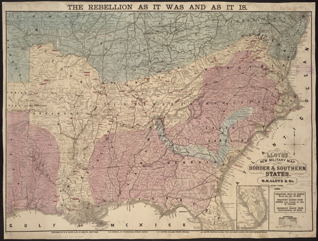
At top of map: The rebellion as it was and as it is.
Shows "territory held by Rebels April 1st, 1865, in red," "territory gained from Rebels since January 1st, 1862, in yellow, " and "Sherman's march from Chattanooga, in blue."
Battlefields are marked by red lines and strategic places, by red dots.
Indicates towns, railroads, rivers, names and boundaries of states, and relief by hachures.
For earlier editions, see Civil War Maps entry nos. 27 and 38.
Description derived from published bibliography.
- Identifier:
-
06_01_007482
- Call #:
-
G3701.S5 1865 .H35
- Barcode:
-
39999059031839
- LCCN:
-
99447178


