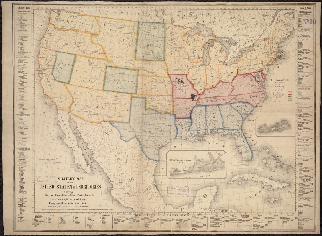
Military map of the United States & territories showing the location of the military posts, arsenals, Navy Yards, & ports of entry. Compiled from pub-doc--1861
Item Information
- Title:
- Military map of the United States & territories showing the location of the military posts, arsenals, Navy Yards, & ports of entry. Compiled from pub-doc--1861
- Creator:
- P.S. Duval & Son
- Date:
-
1861
- Format:
-
Maps/Atlases
- Location:
-
Boston Public Library
Norman B. Leventhal Map Center - Collection (local):
-
Norman B. Leventhal Map Center Collection
- Subjects:
-
United States--History--Civil War, 1861-1865--Maps
- Places:
-
- Extent:
- 1 map : col. ; 60 x 80 cm.
- Terms of Use:
-
No known copyright restrictions.
No known restrictions on use.
- Publisher:
-
Philad[elphi]a :
Published by P.S. Duval & Son
- Scale:
-
Scale ca. 1:6,800,000.
- Language:
-
English
- Notes:
-
Map includes state capitals and principal towns, drainage, geographic coordinates, and names and boundaries of the states and territories.
Military posts and ports of entry are listed at bottom and sides of map.
Insets: Pensacola & Perdido Bays. 8 x 16 cm. -- Key West. 5 x 11 cm.
Description derived from published bibliography.
- Identifier:
-
06_01_007465
- Call #:
-
G3700 1861 .P73
- Barcode:
-
39999059031680
- LCCN:
-
99447019


