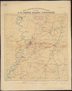
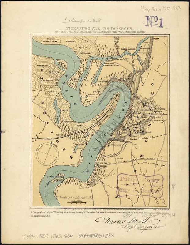
Vicksburg and its defences : constructed and engraved to illustrate "The war with the South"
Item Information
- Title:
- Vicksburg and its defences : constructed and engraved to illustrate "The war with the South"
- Creator:
- Sholl, Charles.
- Name on Item:
-
[Compiled by Charles Sholl] ; Engd. by W. Kemble.
- Date:
-
[ca. 1863]
- Format:
-
Maps/Atlases
- Location:
-
Boston Public Library
Norman B. Leventhal Map Center - Collection (local):
-
Norman B. Leventhal Map Center Collection
- Subjects:
-
Vicksburg Region (Miss.)--History--Civil War, 1861-1865--Maps
Vicksburg Region (Miss.)--Maps
- Places:
-
Warren (county)Vicksburg
- Extent:
- 1 map : col. ; 25 x 17 cm.
- Terms of Use:
-
No known copyright restrictions.
No known restrictions on use.
- Publisher:
-
New York :
Virtue, Yorston & Co.
- Scale:
-
Scale ca. 1:72,500.
- Language:
-
English
- Notes:
-
From Tomes, Robert. The war with the South, New York, Virture & Yorston, 1862-1867. v. 2, between p. 566 and 567.
Signed (facsim.): Charles, Sholl, Topl. Engineer.
"Entered according to act of Congress AD. 1863 by Virtue, Yortson & Co."
Caption in lower margin: A topographical map of Vicksburg & its vicinity showing all batteries that were in existence at the time of its fall, with the names of the owners of plantations, &c.
Description derived from published bibliography.
- Identifier:
-
06_01_007436
- Call #:
-
G3984.V8S5 1863 .S36
- Barcode:
-
39999059031383
- LCCN:
-
99447426