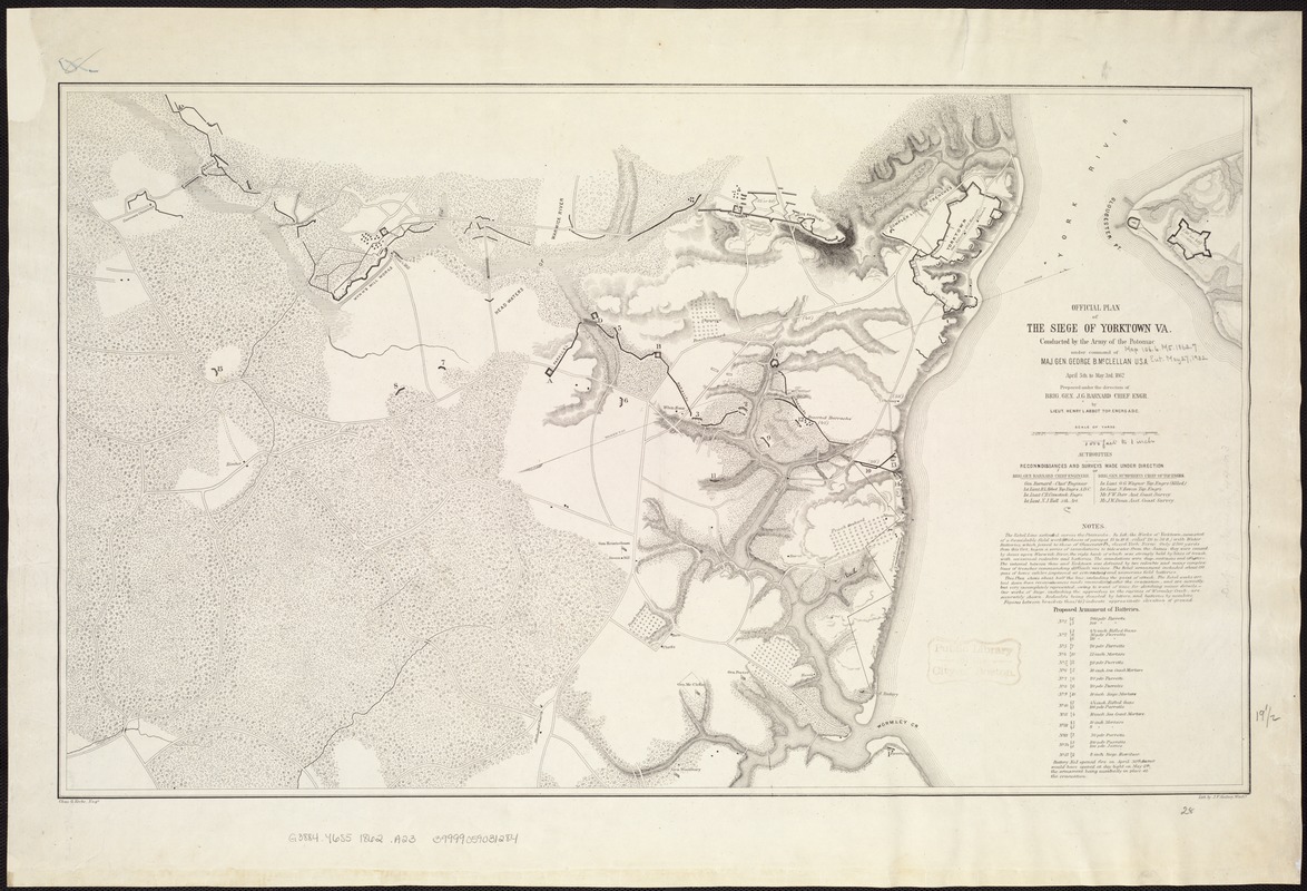
Official plan of the siege of Yorktown, Va. conducted by the Army of the Potomac under command of Maj. Gen. George B. McClellan, U.S.A., April 5th to May 3rd 1862
Item Information
- Title:
- Official plan of the siege of Yorktown, Va. conducted by the Army of the Potomac under command of Maj. Gen. George B. McClellan, U.S.A., April 5th to May 3rd 1862
- Creator:
- Abbot, Henry L.
- Name on Item:
-
Prepared under the direction of Brig. Gen. J. G. Barnard, Chief Engr., by Lieut. Henry L. Abbot, Top. Engrs. A.D.C. Chas. G. Krebs, Engr. Lith. by J. F. Gedney, Washn.
- Date:
-
[1862]
- Format:
-
Maps/Atlases
- Location:
-
Boston Public Library
Norman B. Leventhal Map Center - Collection (local):
-
Norman B. Leventhal Map Center Collection
- Subjects:
-
Yorktown (Va.)--History--Siege, 1862--Maps
- Places:
-
York (county)Yorktown
- Extent:
- 1 map ; 43 x 72 cm.
- Terms of Use:
-
No known copyright restrictions.
No known restrictions on use.
- Publisher:
-
S.l :
s.n.
- Scale:
-
Scale ca. 1:13,500.
- Language:
-
English
- Notes:
-
This plan shows about half the line, including the point of attack. The Rebel works are laid down from reconnoissances [sic] made immediately after the evacuation, and are correctly, but very incompletely represented, owing to want of time for sketching minor details.-Our works of siege, including the approaches in the ravines of Wormley Creek, are accurately shown. Redoubts being denoted by letters, and batteries by numbers.
Contains a list of the "proposed armament of batteries."
Indicates headquarters of Generals McClellan, Porter, Woodbury, and Heintzelman, houses, names of residents, roads, drainage, vegetation, and relief by hachures and spot heights.
Description derived from published bibliography.
- Notes (date):
-
This date is inferred.
- Identifier:
-
06_01_007523
- Call #:
-
G3884.Y6S5 1862 .A23
- Barcode:
-
39999059031284
- LCCN:
-
99446373


