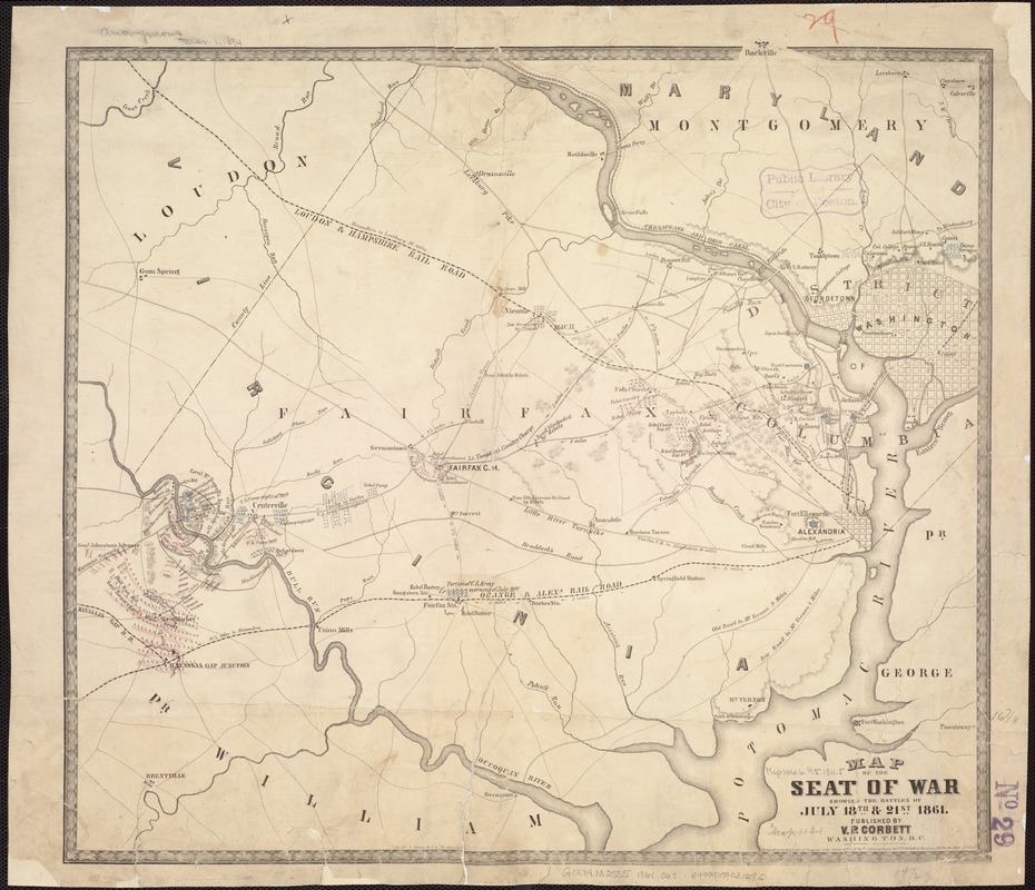
Map of the seat of war showing the battles of July 18th & 21st 1861
Item Information
- Title:
- Map of the seat of war showing the battles of July 18th & 21st 1861
- Creator:
- Corbett, V. P.
- Name on Item:
-
Lith. by A. Hoen & Co., Baltimore.
- Date:
-
1861
- Format:
-
Maps/Atlases
- Location:
-
Boston Public Library
Norman B. Leventhal Map Center - Collection (local):
-
Norman B. Leventhal Map Center Collection
- Subjects:
-
Bull Run, 1st Battle of, Va., 1861--Maps
Virginia--History--Civil War, 1861-1865--Maps
- Places:
-
Manassas (independent city)
Prince William (county)Manassas National Battlefield Park (national park)
- Extent:
- 1 map : col. ; 45 x 51 cm.
- Terms of Use:
-
No known copyright restrictions.
No known restrictions on use.
- Publisher:
-
Washington, D.C :
V.P. Corbett
- Scale:
-
[Scale ca. 1:115,000].
- Language:
-
English
- Notes:
-
Another issue.
Additional details added such as "Camp Sprague," "U.S. Hospital," "Soldier's Home," and other place names in the northern part of Washington, D.C.
Description derived from published bibliography.
- Identifier:
-
06_01_007428
- Call #:
-
G3884.M25S5 1861 .C67
- Barcode:
-
39999059031292
- LCCN:
-
99439201
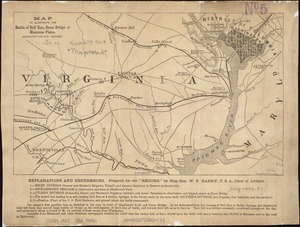

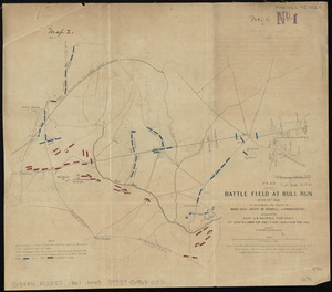
![Map of the battlefield of Bull Run, Virginia. Brig. Gen. Irvin McDowell commanding the U.S. forces, Gen. [P.] G.T. Beauregard commanding the Confederate forces, July 21st 1861](https://bpldcassets.blob.core.windows.net/derivatives/images/commonwealth:ww72bp023/image_thumbnail_300.jpg)