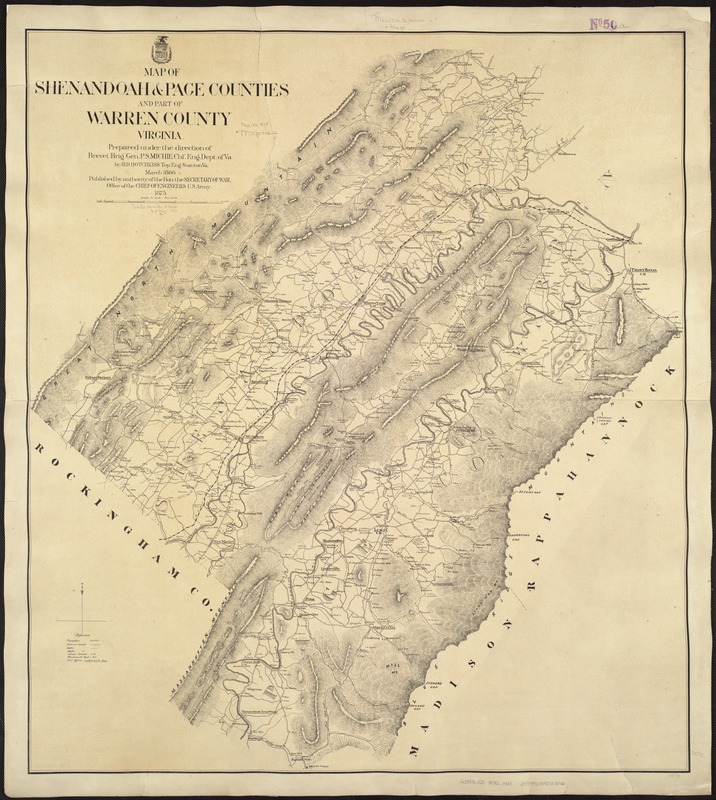
Map of Shenandoah & Page counties and part of Warren County, Virginia
Item Information
- Title:
- Map of Shenandoah & Page counties and part of Warren County, Virginia
- Title (alt.):
-
Map of Shenandoah and Page counties and part of Warren County, Virginia
- Creator:
- Hotchkiss, Jedediah, 1828-1899
- Name on Item:
-
prepared under the direction of P.S. Michie by Jed Hotchkiss, Mar. 1866.
- Date:
-
1875
- Format:
-
Maps/Atlases
- Location:
-
Boston Public Library
Norman B. Leventhal Map Center - Collection (local):
-
Norman B. Leventhal Map Center Collection
- Subjects:
-
Shenandoah County (Va.)--Maps
Page County (Va.)--Maps
Warren County (Va.)--Maps
- Places:
-
VirginiaWarren (county)
VirginiaPage (county)
VirginiaShenandoah (county)
- Extent:
- 1 map ; 89 x 80 cm.
- Terms of Use:
-
No known copyright restrictions.
No known restrictions on use.
- Publisher:
-
[Washington] :
Published by authority of the Hon. the Secretary of War, Office of the Chief of Engineers, U.S. Army
- Scale:
-
Scale [1:84,480].
- Language:
-
English
- Notes:
-
Shows roads, railroads, public buildings, and houses labeled by owners' names.
Relief shown by hachures.
- Identifier:
-
06_01_007433
- Call #:
-
G3883.S3 1875 .H67
- Barcode:
-
39999059031342


