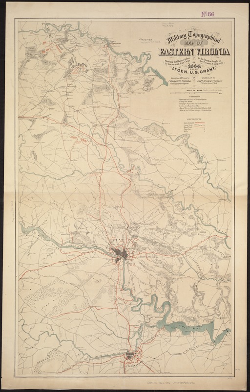
Military topographical map of eastern Virginia showing the routes taken by the several army corps & the battles fought in the present campaign of 1864 under Lt. Gen. U. S. Grant
Item Information
- Title:
- Military topographical map of eastern Virginia showing the routes taken by the several army corps & the battles fought in the present campaign of 1864 under Lt. Gen. U. S. Grant
- Creator:
- Sholl, Charles.
- Name on Item:
-
Compiled and drawn by Charles Sholl, Civil & Topographical Engineer ; Entered according to Act of Congress A.D. 1864 by R. Chauncy ...
- Date:
-
[1864]
- Format:
-
Maps/Atlases
- Location:
-
Boston Public Library
Norman B. Leventhal Map Center - Collection (local):
-
Norman B. Leventhal Map Center Collection
- Subjects:
-
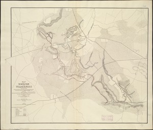
Wilderness, Battle of the, Va., 1864--Maps
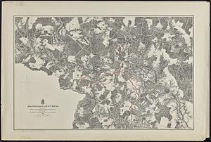
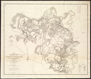
Spotsylvania Court House, Battle of, Va., 1864--Maps
Virginia--History--Civil War, 1861-1865--Maps
- Places:
-
Spotsylvania (county)Spotsylvania Court House Battlefield (historic site)
- Extent:
- 1 map : col. ; 91 x 56 cm.
- Terms of Use:
-
No known copyright restrictions.
No known restrictions on use.
- Publisher:
-
New York :
Published by Capt. R. Chauncy
- Scale:
-
Scale ca. 1:135,000.
- Language:
-
English
- Notes:
-
Includes fortifications surrounding Richmond and Petersburg, roads, railroads, drainage, vegetation, towns, and houses.
Description derived from published bibliography.
- Notes (date):
-
This date is inferred.
- Identifier:
-
06_01_007426
- Call #:
-
G3881.S5 1864 .S56
- Barcode:
-
39999059031276
- LCCN:
-
99448882