Perrine's new topographical war map of the southern states : taken from the latest government surveys and official reports
Item Information
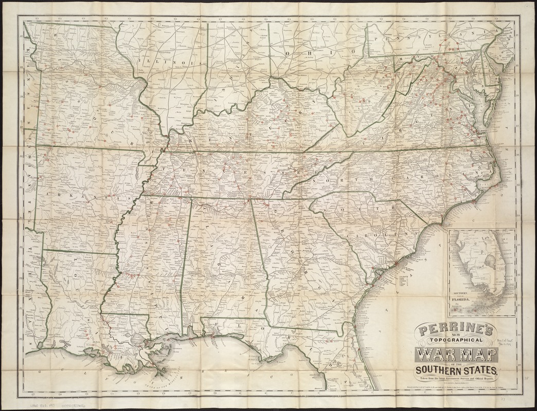
- Title:
- Perrine's new topographical war map of the southern states : taken from the latest government surveys and official reports
- Creator:
- Perrine, C. O. (Charles O.)
- Date:
-
[ca. 1863]
- Format:
-
Maps/Atlases
- Location:
-
Boston Public Library
Norman B. Leventhal Map Center - Collection (local):
-
Norman B. Leventhal Map Center Collection
- Subjects:
-
United States--History--Civil War, 1861-1865--Maps
Southern States--Maps
- Places:
-
Southern United States (area)
- Extent:
- 1 map : col. ; 68 x 89 cm.
- Terms of Use:
-
No known copyright restrictions.
No known restrictions on use.
- Publisher:
-
Indianapolis, Ind :
[C.O. Perrine]
- Scale:
-
Scale [ca. 1:2,000,000]
- Language:
-
English
- Notes:
-
Relief shown by hachures.
"Entered according to Act of Congress, in the year 1863, by C.O. Perrine ..."
Prime meridians: Greenwich and New York.
"E.R. Jewett & Co., Engravers, Buffalo, N.Y."
Inset: Southern part of Florida.
Also appears bound in to: Bishop, John Soast, 1834-1915. A concise history of the war. Indianapolis, Ind. : C.O. Perrine, [c1864].
- Identifier:
-
06_01_007416
- Call #:
-
G3860 1863 .P47
- Barcode:
-
39999059031086
- LCCN:
-
85690668


